We have some fascinating memories and oral history in our page: Community Asset for 20 years , along with some great photos!
  |
Marisa Dennington, Havelock Road, since 1959.
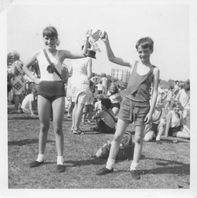
It was already a field when I moved here in 1959, but the lady down the road, who had moved in 8 years earlier remembered it being grassed over.I was told that in the war there were two big guns (anti-aircraft) in there as it was a very big pit. And, there was half a house left (from the WW2 bombing) at number 43 with all the children playing in it. Every year at the end of the year, Raglan school would have a sports day on the brickfield, and my Maurizia was the champion running. At the weekend, the Raglan boys used to come and play football with the teacher.We used to go there in the evening as a family and play tennis and badminton.My Maurice would never allow us to picnic on the other side of the field, it had to be in our corner. |
|
Our Local Road Names
Our local road names recall some of the famous people and places in our imperial past, that were popular at the times the roads were built: History of our Local Road Names
History of the Brickfield and Local Area
With thanks to Tony Deary, who did vast amounts of research in the Local Studies area and the internet, Felix for his work, and especially all the people who have composed and contributed their recollections of our park.
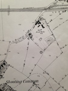 |
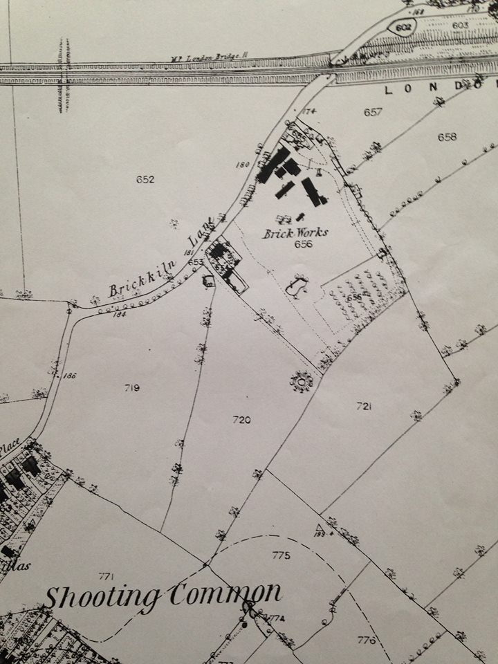
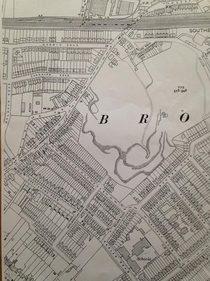
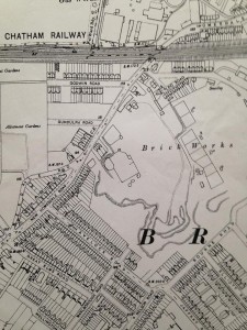
1863: there’s fields around, you can see the bridge over the railway without either Murray Avenue or Wendover Road to join up to it. The field to the SE of the brickworks could be an orchard, or it could have been the outdoor tile drying field that was said to be there. The numbers in the fields are apparently lot numbers.At the bottom you can see the old Shooting Common, which our park is the sole remainder. |
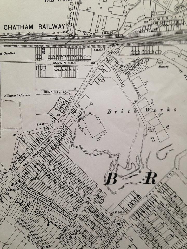
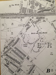
| 1897 The Brick and Tile works are there, and Homesdale road by it’s old name, Brick Kiln Lane. The well is still marked in the boggy bit by the side of where the Nursery is now. The farm is still there. The only remnant of the farm is the large Bay tree in one of the gardens of Havelock Road.Godwin and Gundulph Roads are not built yet. |
 |
 |
The brickworks were owned by J Pascall, and his name can be found on the bricks and tiles of Rose Cottage, formerly a laundry, Chislehurst: “the typical handmade red bricks of the period all being manufactured locally at the long-gone Chislehurst brickworks (at the time, Widmore green and this area was called Chislehurst West), that stood on Red Hill. Evidence for this is seen in the name “J Pascall”, found on many bricks, and on some of the original chimney pots.” |
|
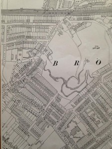
An old map from 1909: you can see that Bourne Road is only partially completed and Fashoda has no houses. The pit has extra levels at the SE side, presumably where it is deeper.
From a Facebook post from Jane Evans: “My husband’s family sold the brickfield – we think late 1920s – have papers from buying not selling. Have some anecdotal stuff – not least mires with cart horses dead in them…”
|
 |
 |
Tony: “1933 now just a quarry brick and tile works has moved to Chislehurst caves”
|
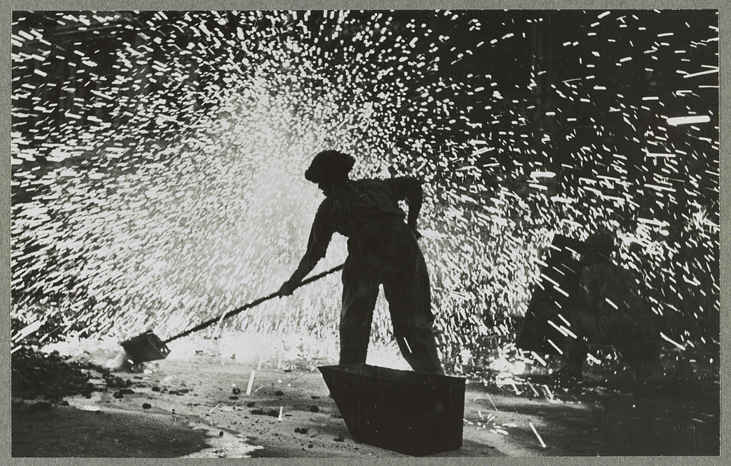
From Greater London Industrial Archaeology Society (GLIAS):Lime burning was not the only extractive industry in Chislehurst. Further east (confusingly, in the area known as Chislehurst West) there were at least two brickworks on London Clay. In Red Hill, Joseph Pascall appeared in Kelly’s Directory for 1862 as a brick and tile maker and potter; by 1870 the firm traded as George & Amos Pascall and later as Pascall Bros. (Red Hill, Chislehurst; also Bromley and St Mary’s Cray). In 1899, E A Webb, G W Miller and J Beckwith wrote in ‘The History of Chislehurst’ that ‘proceeding up Red Hill — now generally called White Horse Hill — we pass on the left Pascall’s Tile Works, recently closed owing to the death of its proprietor.’ Pascalls appeared in local directories in 1897 but not 1898. Further north, on the west side of White Horse Hill, by 1901 directories show White Horse Hill Brickworks (A T S Carter Ltd) but there seems to have been a brickyard here earlier. It had closed by 1930 but probably quite recently, because it was still shown on maps.
Sand was also extracted. Whitaker (1872) noted a large old pit in Thanet Sand on the south of the road to Bromley (ie, Old Hill) ¾ mile west of Chislehurst church. In 1866 he found that its floor was the layer of hard chalk which served as the roof of the galleries at Camden Park. |
|
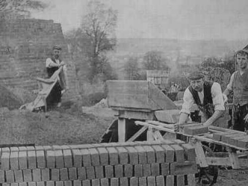
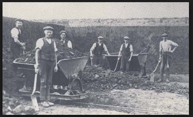
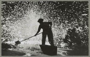
Contemporary Brick works photos
Local Victorian Photos
These are from Ideal Homes website:
 |
 |
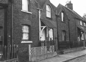
| ‘Improvement Cottages’ in Waldo Road (now demolished) |
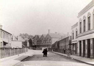
Homesdale Road, looking uphill towards Widmore Green from the Lord Holmesdale, 1910. |
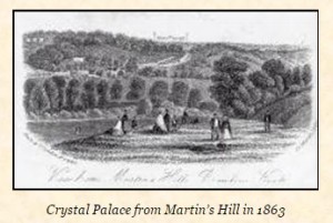 You can see from this picture that it is drawn before the Shortland Pumping station was constructed. Martin’s hill may be named after a local baker, or because the house martins used to congregate in the thermals there. You can see from this picture that it is drawn before the Shortland Pumping station was constructed. Martin’s hill may be named after a local baker, or because the house martins used to congregate in the thermals there. |
|
Bromley Common’s early cricket ground is believed to have been in the area of Brick-Kiln Lane (now Homesdale Road), where a connection can be made with the local game and the Norman family. George Warde Norman (1793 to 1882) mentioned in his memoirs that he played there. He was a member of a family which had extensive lands around the south of Bromley, including Bromley Common. The Norman family name is continued locally, with a large local park being named after the family.
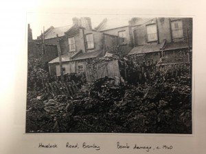
War Time Photos and Accounts
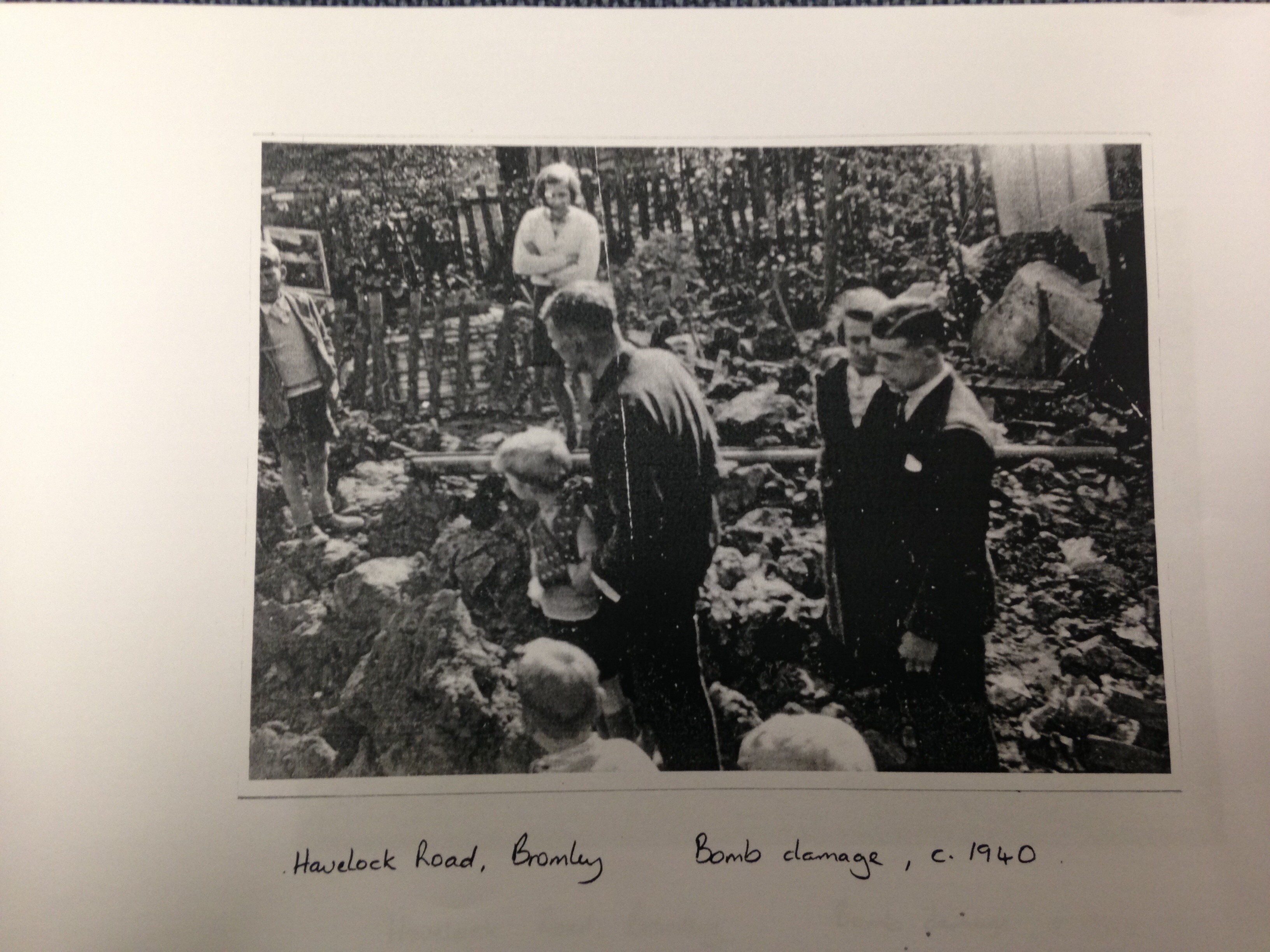
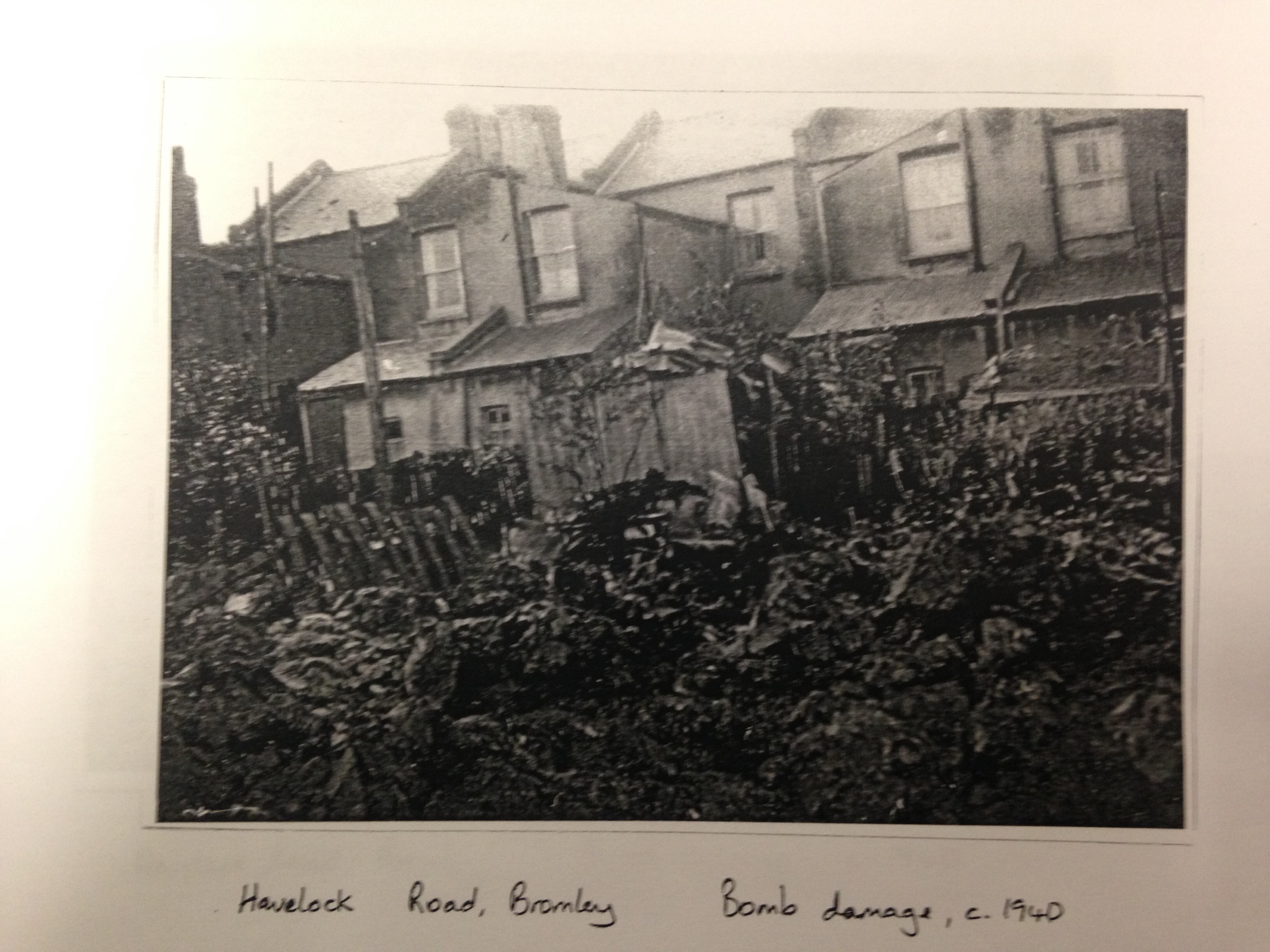
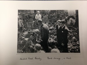
In 1940 in particular, Havelock Road suffered considerable bomb damage in the Blitz. The block of flats now occupying numbers 24-41 Homesdale Road are the result of an arial mine. This explosion also destroyed the chicken cabins at the back of 21 Havelock Road.
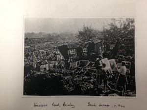 |
Photo of bomb damage in 1940. In the background of this picture you can see heaps of rubble, and faintly, at the back, the pit. |
| Mrs T Coombes, daughter of J.Pepper (Headmaster of Raglan Road Junior School 1941-59 and previously master in Senior Boys) in Raglan School’s Centenary 1889-1989:Something I shall always associate with wartime is seeding grass – it grew along every pavement and at the bottom of every fence This contributed to the general air of shabbiness in the streets. The houses mostly had peeling paint, gates leaned on their hinges or were propped open, and windows were obscured by sticky netting or replacement parchment, or were blacked out with old lino or impenetrable dark air raid curtains. The disused brickfield behind Havelock Road, which was used as a tip for industrial and household rubbish, was an irresistible adventure playground. We called it the Brickie and would sometimes wander there at lunch break and scramble about through the rubbish via little pathways, having to take care to avoid the more unpleasant patches. |
   |
 |
Some recollections from Arthur Sheppeck, who played in the brickfield, mainly from 1941 to 1949, …He remembers the Brick Pit being 60 feet deep….One day, the ARP warden approached us boys. He told us “For God’s sake don’t do what I’m going to do” and he took the incendiary bomb he was carrying and lobbed it into the pit. It exploded with a blinding flash of white light, and the warden told us “that could have been you”. I can tell you, it fair put the wind up us. |
|
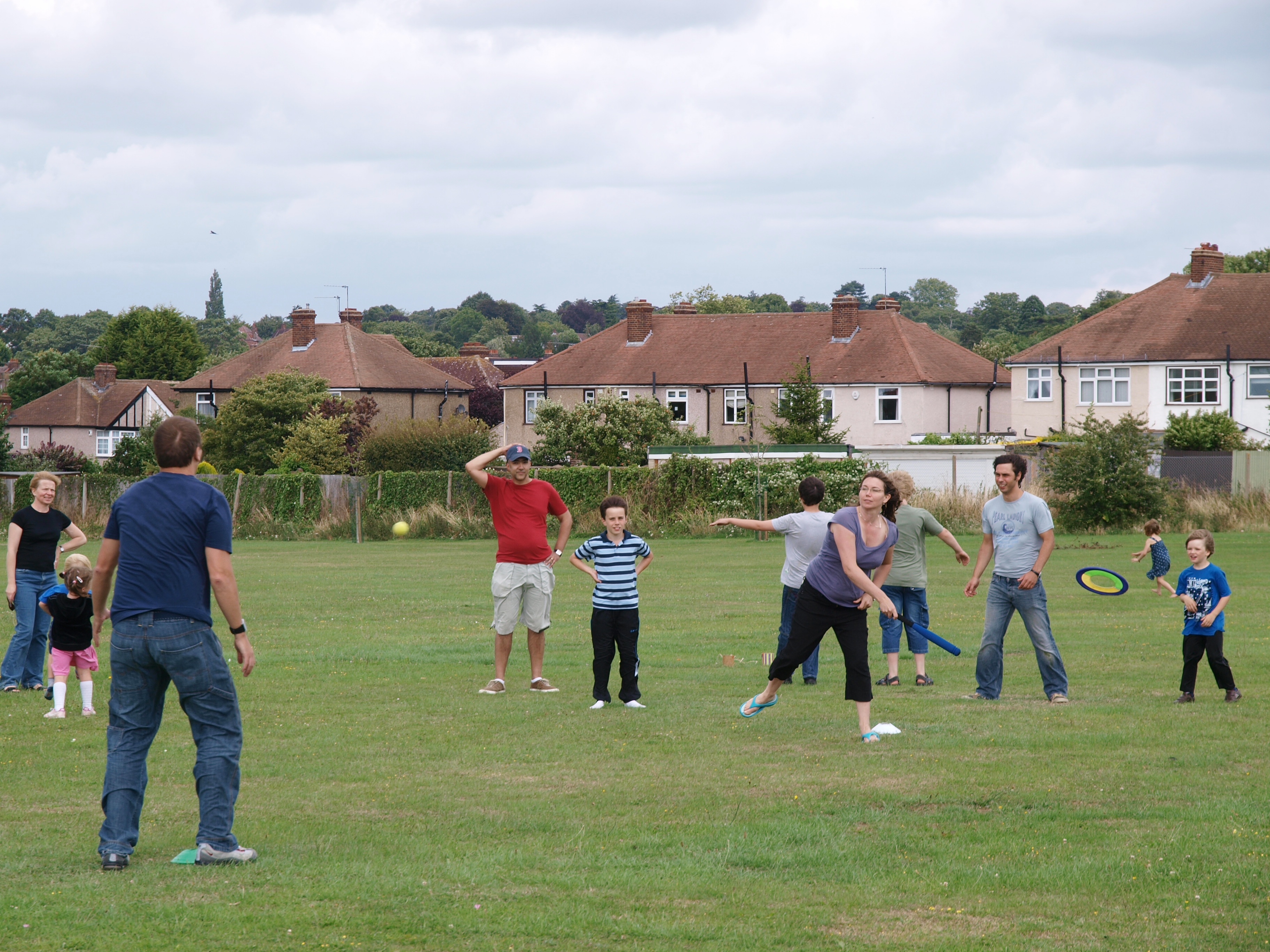
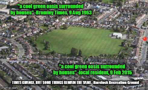
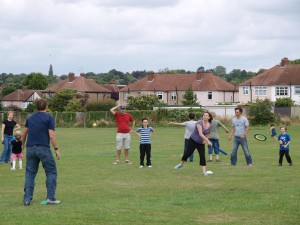
1953 and the transformation into a community Recreation Ground:
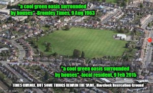
A report from the Bromley Times, from 9 August 1963:
“Bromley’s new oasis … what was an ugly brick works and later a tip for the local Gas Board, has now been converted by Bromley Council in to an attractive stretch of grassland which, during the long summer weeks of school holidays, should be a boon for mothers in the Bromley Common area”
4,781 total views, 1 views today