We have created a virtual tour of our park, including some of the fascinating memories, that older local residents have sent us.
There are 12 stops around the park:
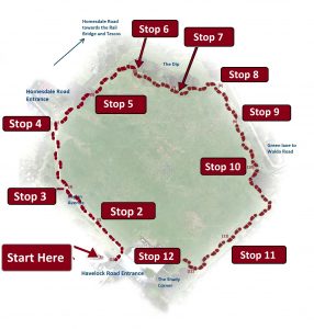
Map of Havelock Recs showing the stops on the Virtual and Audio tours
We have created a virtual tour of our park, including some of the fascinating memories, that older local residents have sent us.
There are 12 stops around the park:
Map of Havelock Recs showing the stops on the Virtual and Audio tours
In the shady corner of the Park
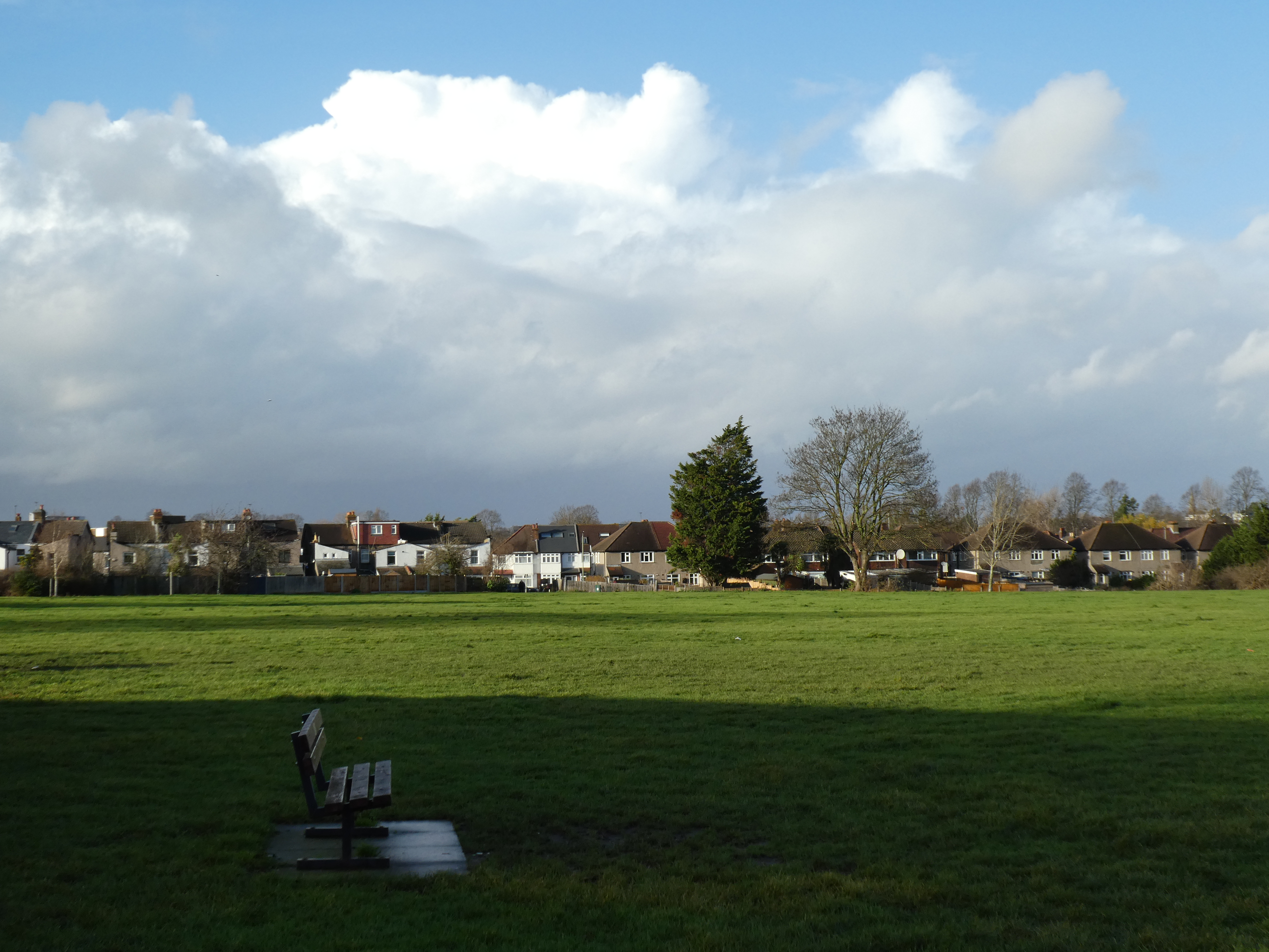
View of park from the memorial bench
Previous Stop – Back to Beginning
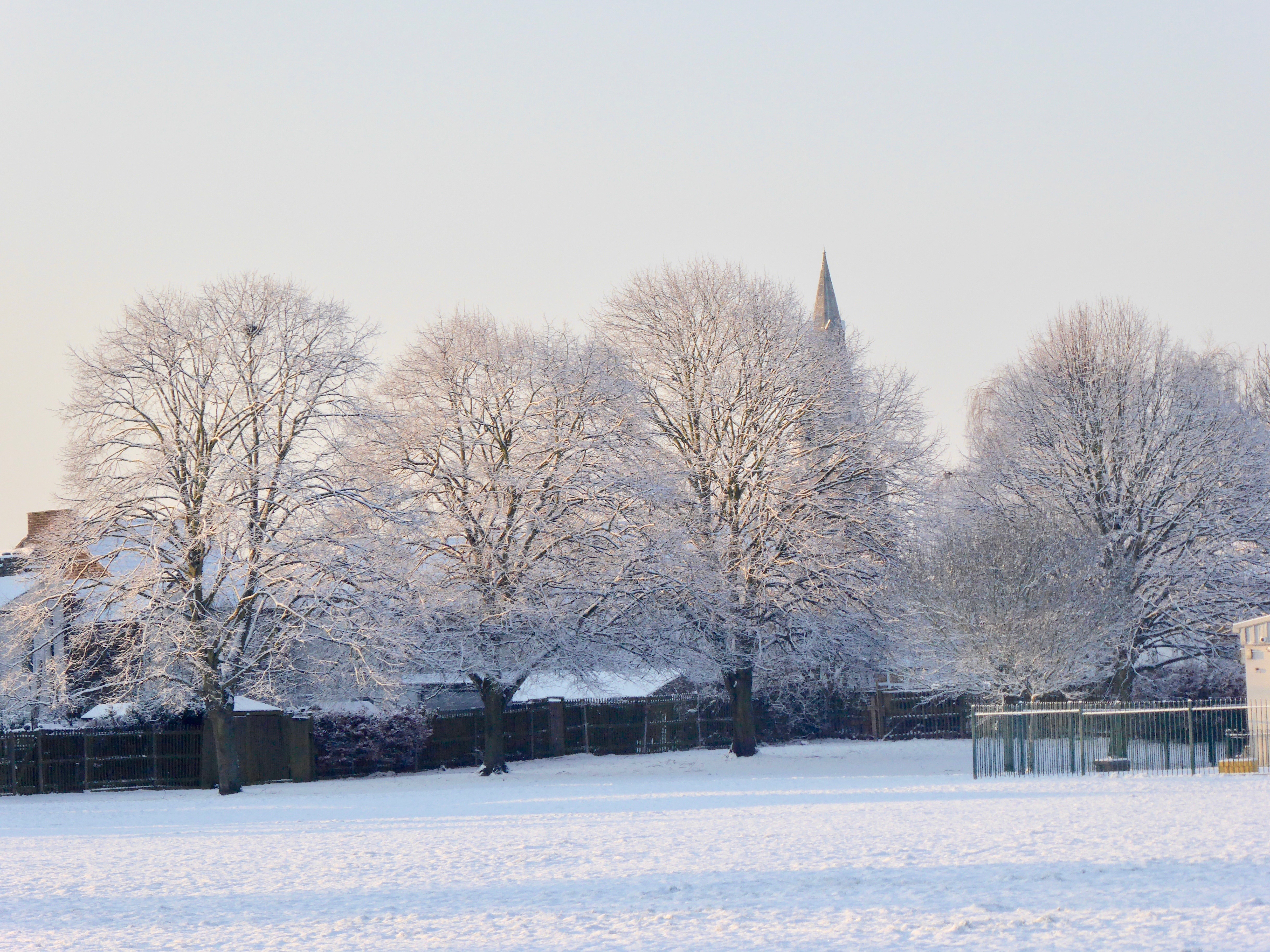
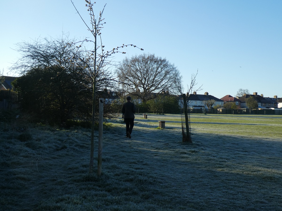
St Luke’s church behind frosty trees in the Shady Corner
Narrator: Originally the park had a small pavilion, the site of which is under part of where the nursery is now. It was built for football players, and the park was used for training by Millwall FC.
Felix: “Bromley’s new oasis … what was an ugly brick works and later a tip for the local Gas Board, has now been converted by Bromley Council in to an attractive stretch of grassland which, during the long summer weeks of school holidays, should be a boon for mothers in the Bromley Common area” – the Bromley Times, on the 9th August 1953.
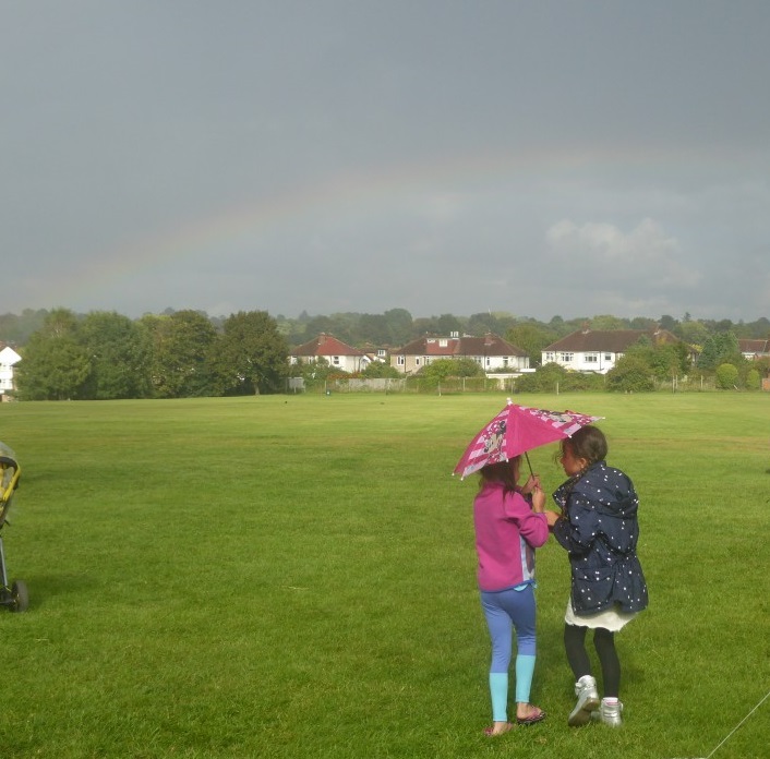
Girls in rain-shower at our Hoedown event
Fiona’s memory from 2015, read by Rebecca:
“I remember playing here as a child, just to run around or play ball games with friends/siblings. Once, I actually ran away from home and packed my tiny suitcase and went down and hid in the dip at the end. It only lasted for about half an hour, until I got cold and decided to go back home again. I moved back into the area in the mid-90s and both my children have enjoyed playing on the wide open field, building snowmen and sledging, and they both learned to ride their bikes and fly kites there.”
Narrator: To return to the start point at the Havelock Road entrance, continue along the front of the nursery past the two benches – then the entrance is on your left.
 Rain clouds from Havelock Rec |
We hope you have enjoyed our tour and walking around the park. Thank you for listening. There is more local history and information on our website, the Friends of Havelock Rec. We also thank all the local people who gave us their recollections of the park in yesteryear. | |
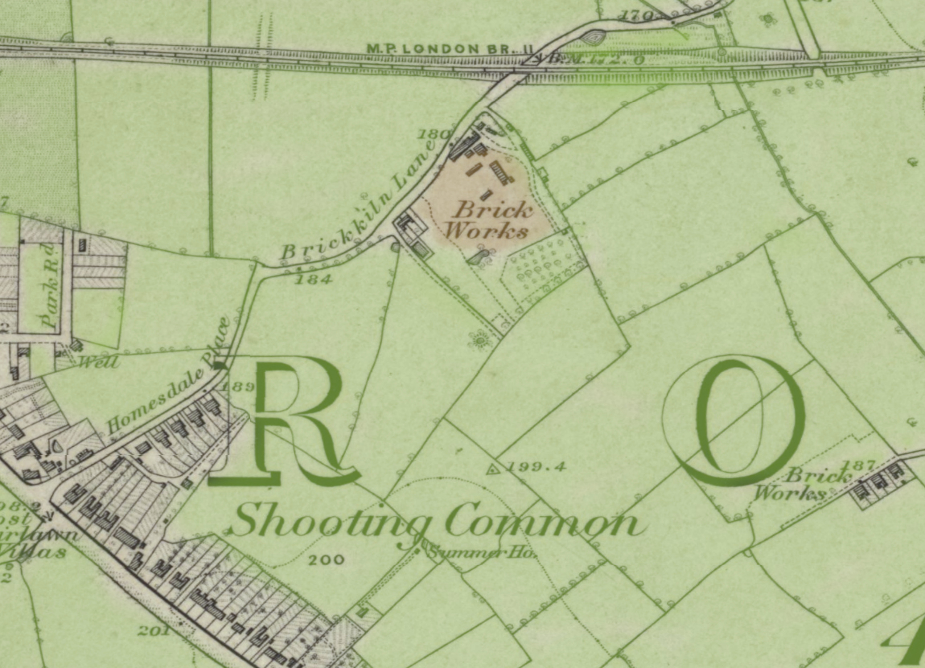
1857 |
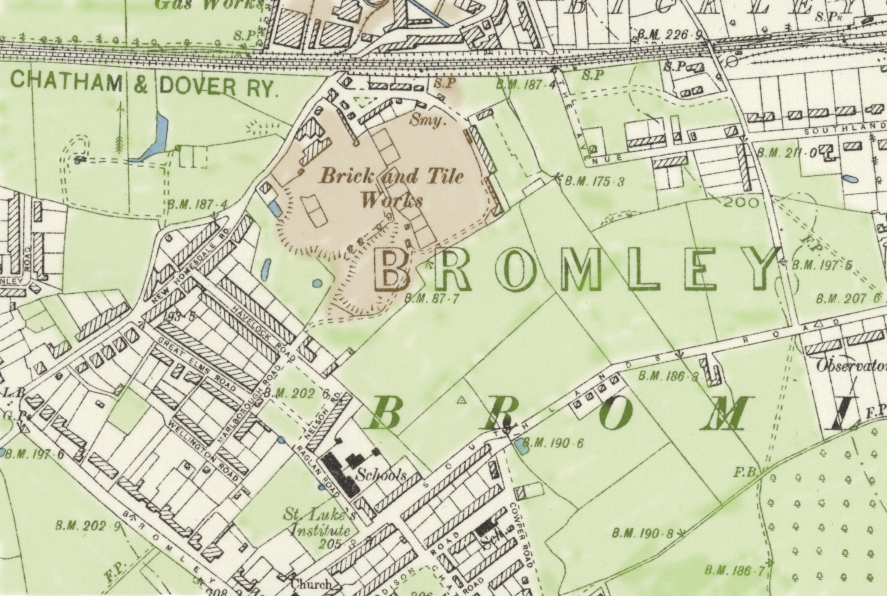
1865 survey published 1871
|
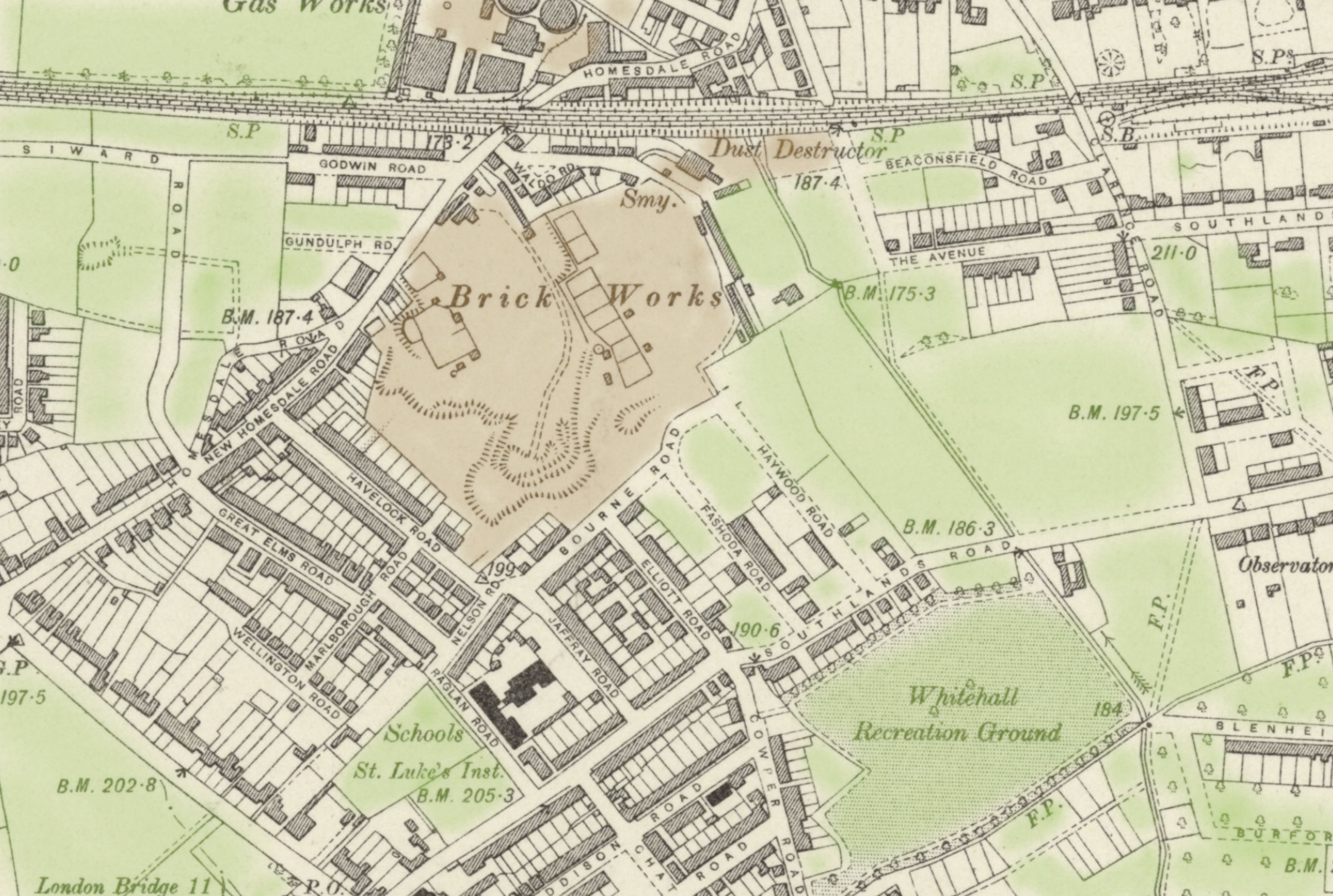
1898
|
| 1903
|
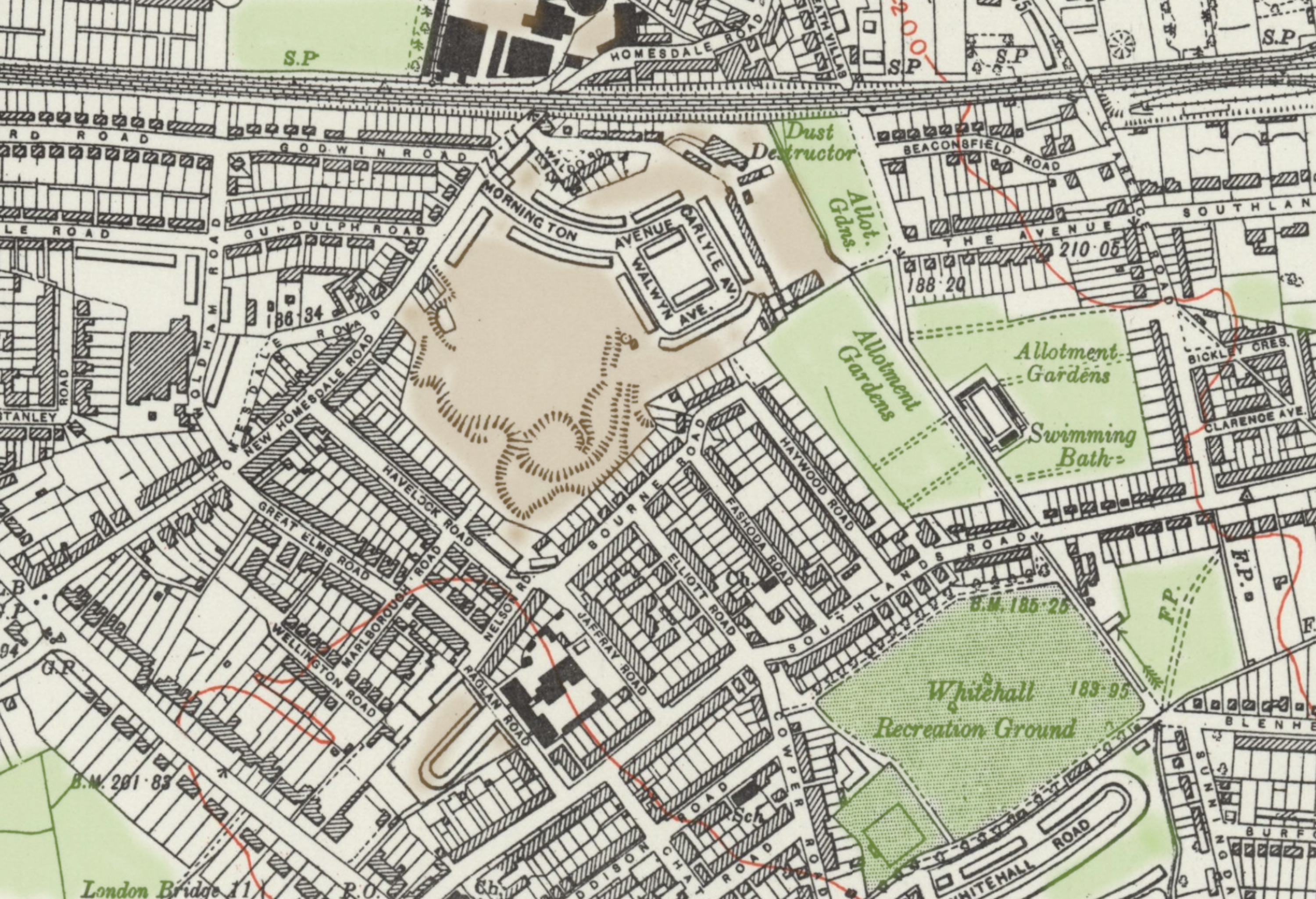
1933
|
Google:
|
| Tinted maps from 1857, 1865, 1898, 1903 and 1933 of the Brick-pit and surrounding area, where Havelock Rec is now. Final image is a Google Satellite picture of 2020. | ||
Halfway down the Bourne Road side of the park.

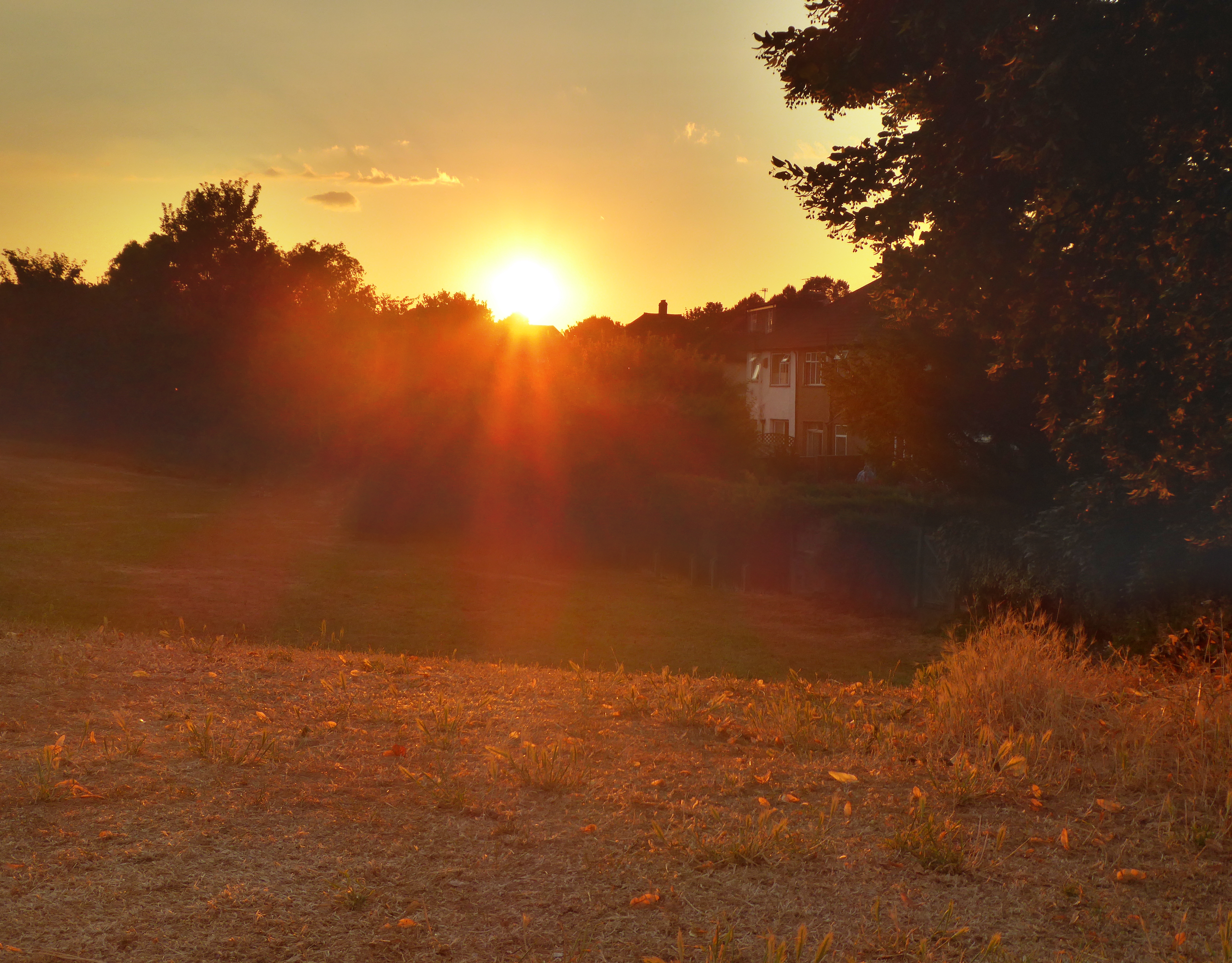
Sunset from Havelock Rec
Narrator: This part of the field is behind Bourne Road, and the space in front of you is the best spot in Bromley to capture a good sunset on your camera!
Narrator: In the first decade or so after being grassed over, our park was used for football club training, by Millwall FC. This had to be abandoned, when a piece of glass worked it’s way up from the landfill, and injured a player. Until the last few years, Millwall FC would still hold an annual dinner at one of the restaurants on Homesdale road.
GASP football club practise on Saturday mornings
Read by Andrew: “Tony, my friend, a retired butcher was telling me that during WW2, they used the pits to dump the debris from bombed houses, things like bricks, wood, house fittings etc. After the war the area was grassed over and used as a football pitch. Problem was that even when things are buried, the lighter materials come to the surface, and this includes the broken glass from all the house windows, which resulted in some pretty horrific injuries. Imagine the consequences of a slide tackle over broken glass . . .” Daniel Bentley writing as Chatterton Road History Society, in 2017
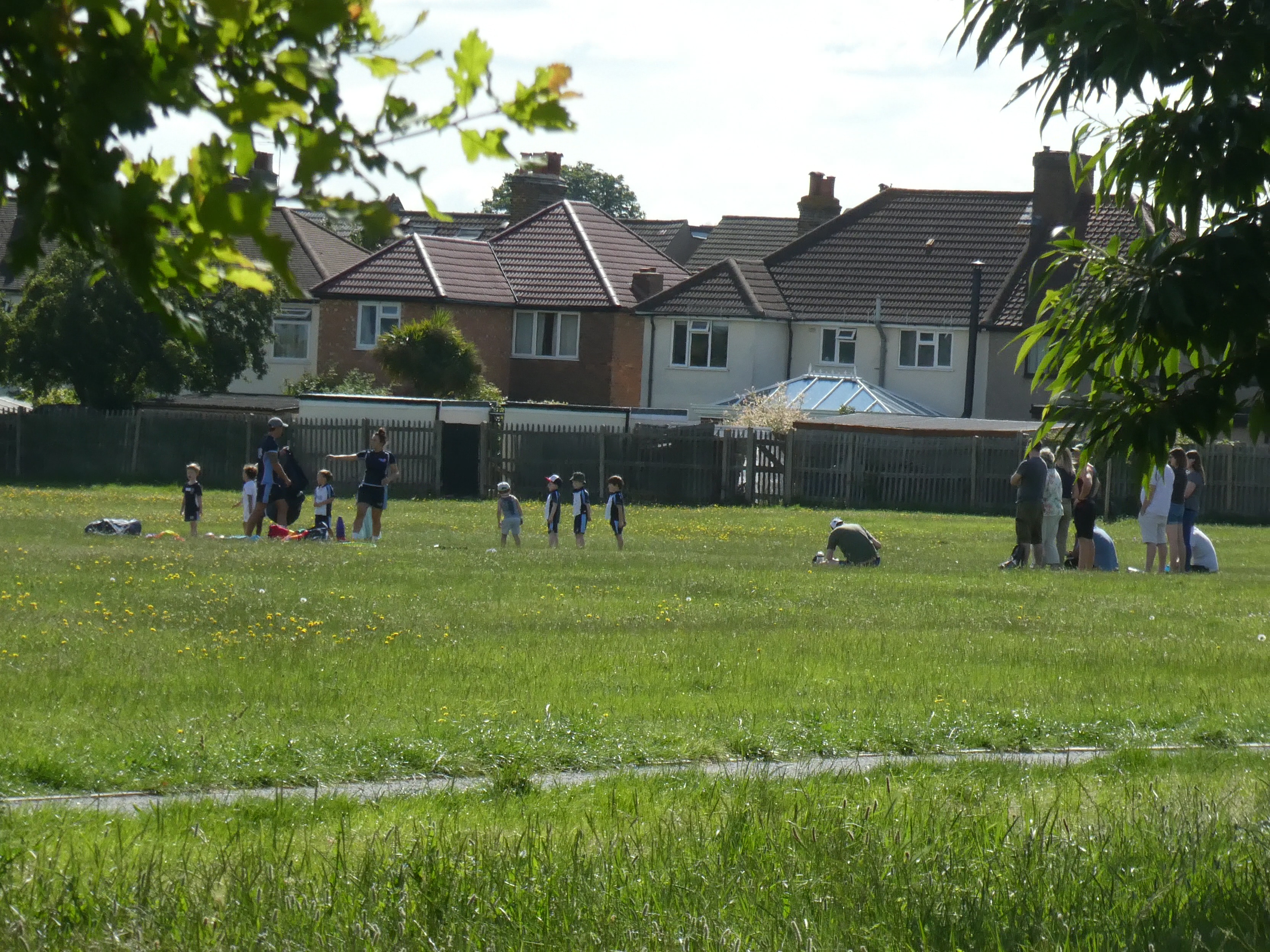
Narrator: The local scout group, 3rd Bromley, regularly use the park for their activities, and have done so for a long time….
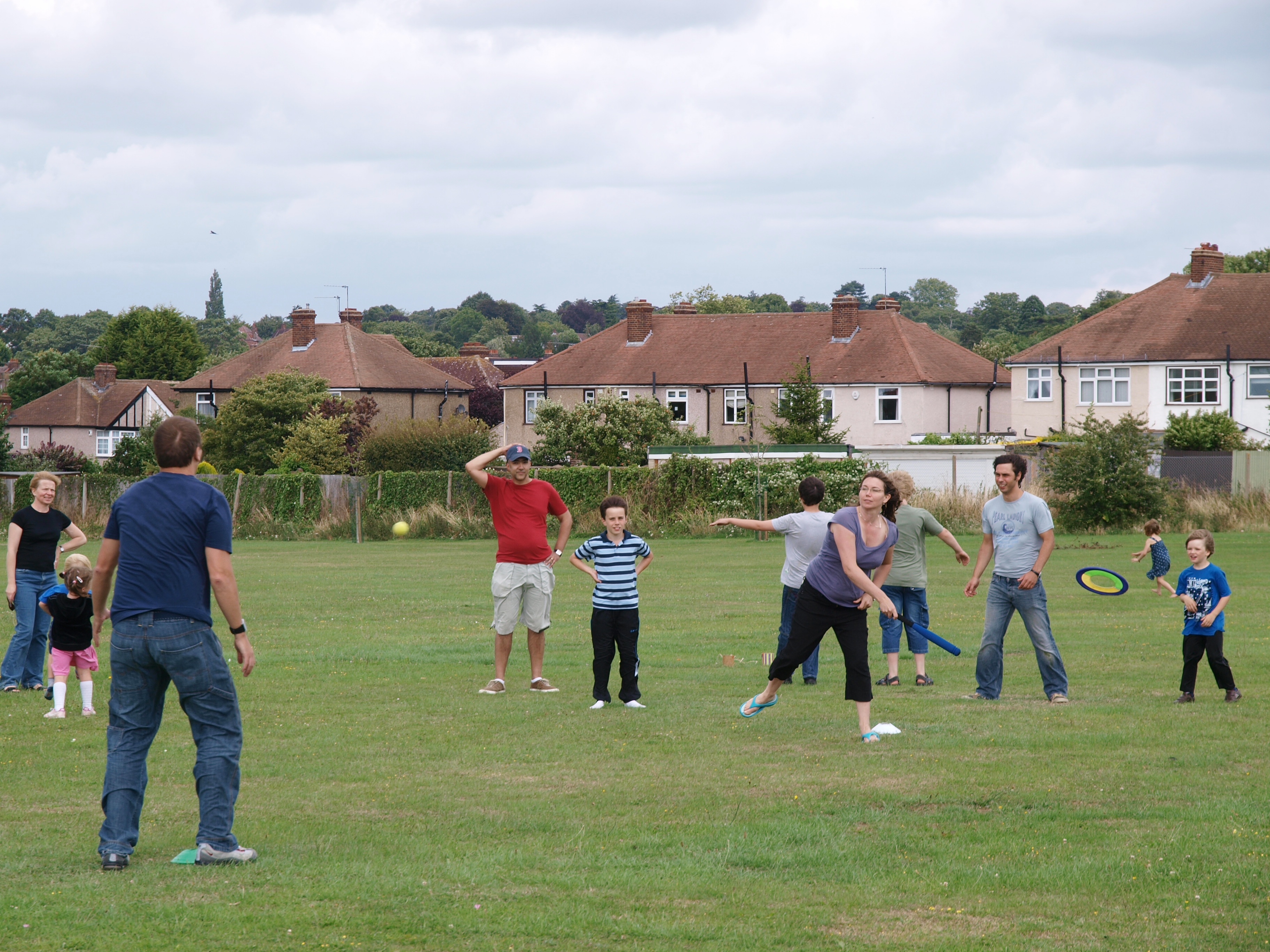
3rd Bromley scouts and parents playing ball games on the park
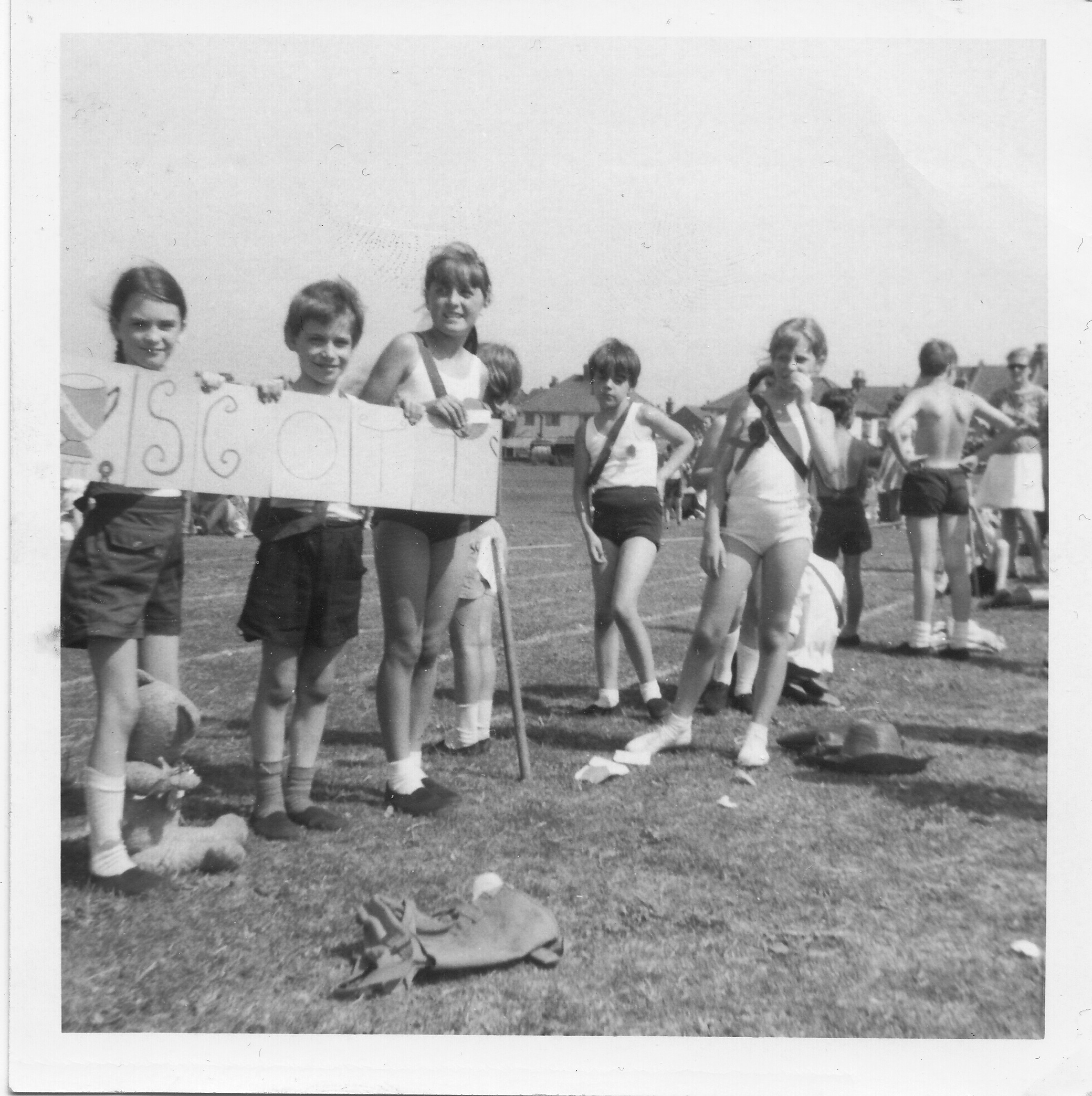
Lilian’s memory from 2015, read by Sandra: “The Queens Silver Jubilee celebration was A Big Do, and the community got together on the Brickfield. Like most of the marquees, the Scout’s pavilion did games for the kids. I believe there was also a Tea Tent, nowadays you’d probably call that a refreshment tent. Mostly everyone put on games and sporty things for the kids. At the time Jean New was the Akela, and she lived in Mornington avenue, at number 4 – opposite me at number 5a – which is how I got involved in the first place. She used to use the Brickfield for cubs. The Brickfield is the only open space that the scouts can do the parts of their organisation’s programme, including: ball games, compass work and teaching tent pitching.”
Narrator: Continue down the side of the park to the shady corner with the large trees, next to the Nursery.
At the Green lane entrance to the Park, by the Large Oak in the Neighbour’s garden.
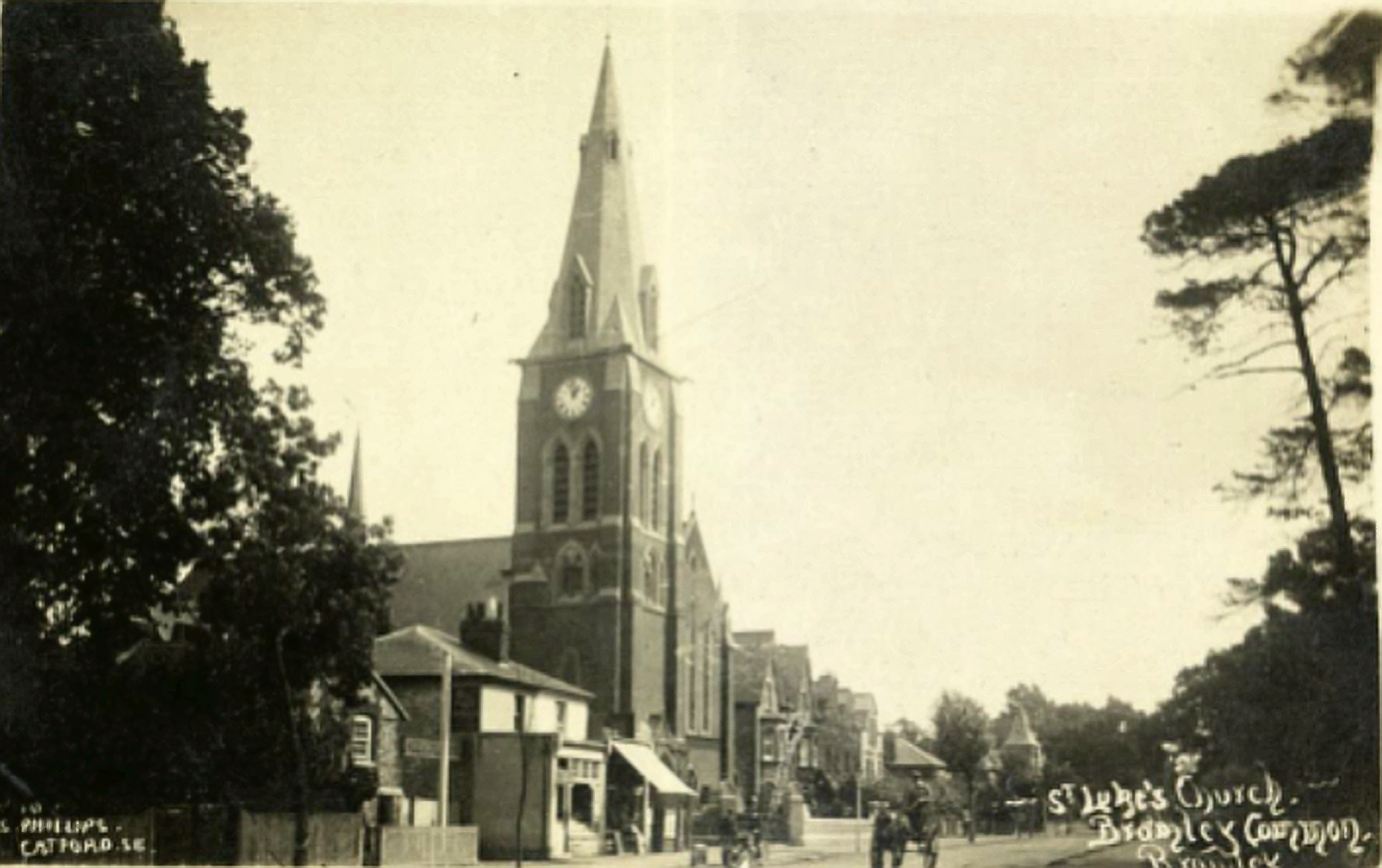
1925 St Lukes Bromley-Common thanks to Chatterton Road History Society
Narrator: Look towards the opposite side of the park, where you can see the spire of St Luke’s church, Bromley Common – behind the trees in the corner. The park is in the parish of St Luke’s.
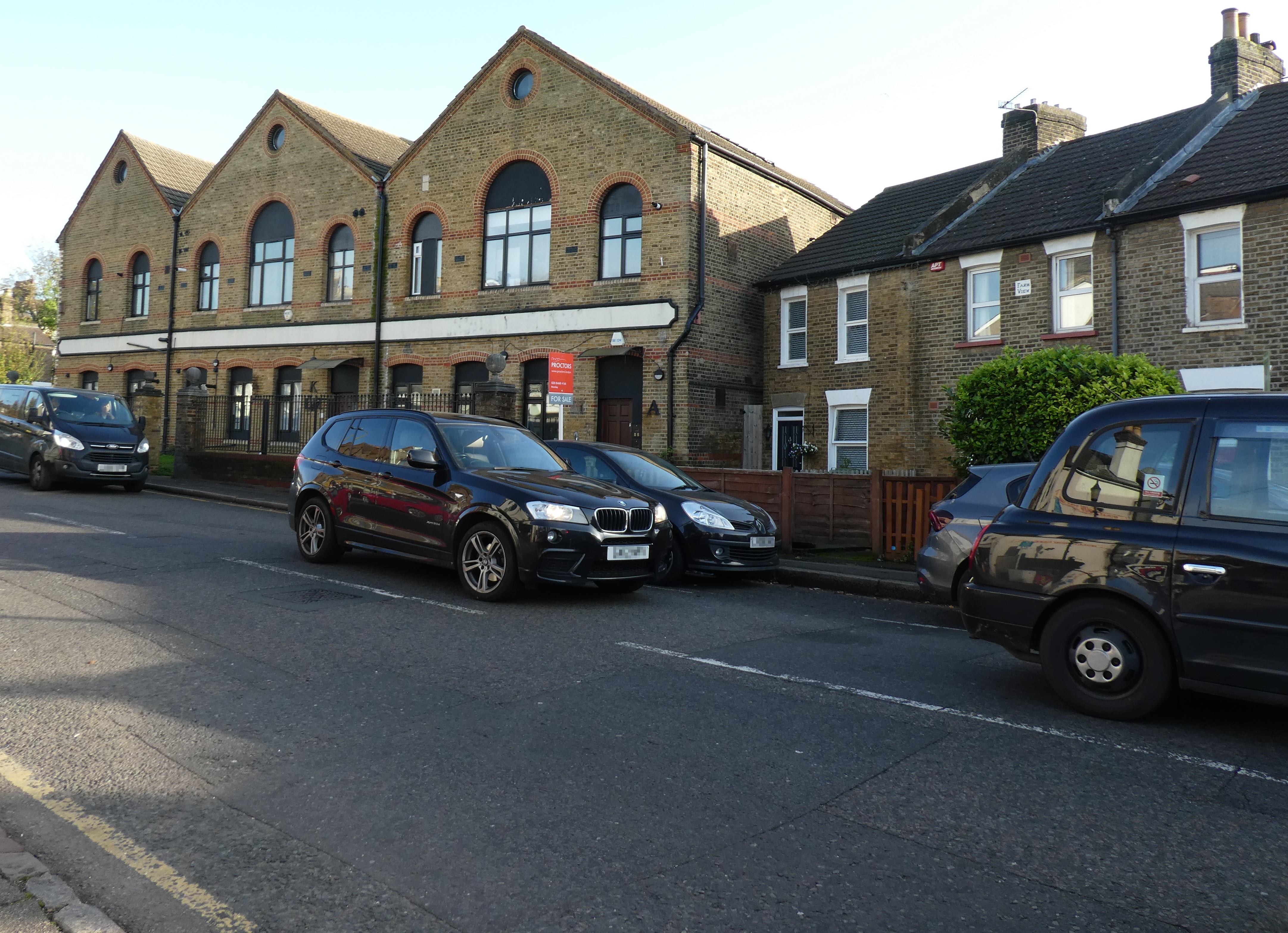
Henry Podger’s Laundry, rebuilt 1884. Phone 2020-11-07.
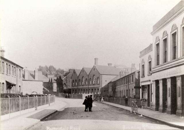
Homesdale Road in 1910, with Henry Podger’s laundry in the centre.
Narrator: On Homesdale Road, just past the Gas Works, is a brick industrial building. It is not a coincidence that this is over where the Blackbrook, or Ravensbourne West ‘river’ crosses Homesdale Road. It was built by Henry Podger, who was the son of a farmer, who, on hard times, was convicted of thieving from his employer in 1842. In Henry’s early years, he worked at Woolwich Arsenal, and then set up a laundry business here in 1864, using the stream’s water until mains water arrived.
Henry Podger is described as a real “Rags to Riches” story, and was so successful that he opened 3 shops in Bromley, and specialised in difficult items such as hat plumes and furniture, using machinery that he designed himself – including the first collar ironing machine, which was shown at the International Health Exhibition in 1884. The current building was rebuilt after a fire in 1886. The laundry employed many local people until the 1920s.
Until the 1980s, the field was used by the local School, Raglan Road Primary.
Marissa’s memory, narrated by Jo: “The brickfield was already a grassed playing field when I moved here in 1959, but the lady down the road, who had moved in 8 years earlier remembered it being grassed over. The work was done by the contractors, the Macintoshes. I was told that in the war there were two big guns (anti-aircraft) in there as it was a very big pit. And, there was half a house left (from the WW2 bombing) at number 43 (Havelock Road) with all the children playing in it. Every year at the end of the year, Raglan school would have a sports day on the brickfield, and my Maurizia was the champion running one year. At the weekend, the Raglan boys used to come and play football with the teacher. We used to go there in the evening as a family and play tennis and badminton. My Maurice would never allow us to picnic on the other side of the field, it had to be in our corner.
The Brickfield was left to the children of Raglan Road School, and the council was to look after it on their behalf.”
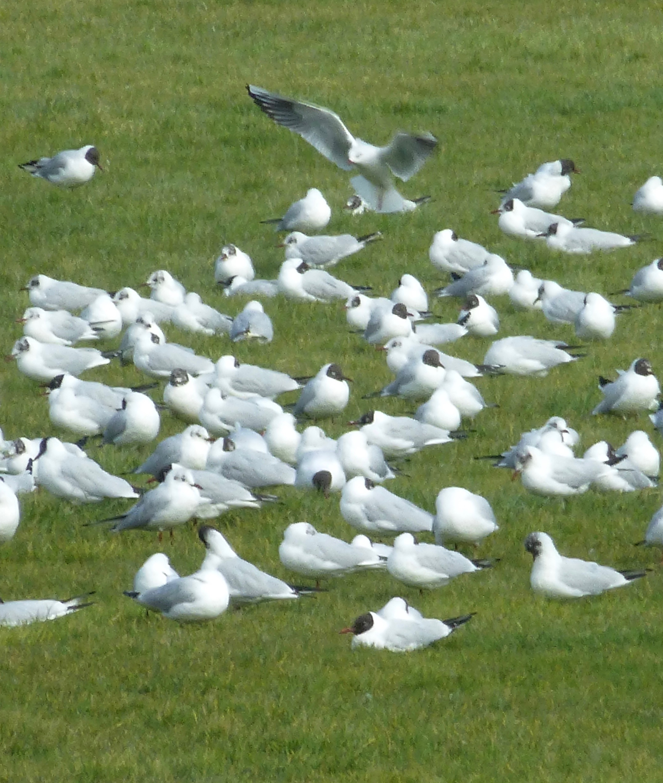
Gulls roost on Havelock Rec
Narrator: In recent years – since about 2016 – the park has been used, as a roost for the Herring gulls and Black headed gulls, who forage at the waste transfer station at Waldo Road. Before the gulls arrived, there had been a large flock of hundreds of carrion crows, who had supplemented their rubbish diet with the local song birds. As the Herring gulls have moved the crows on, song birds have recovered in the park and local gardens.
Continue along the edge of the park, round the corner, and down the side.
This part of the park is over the deepest part of the pits; the map shows 3 tiers of slopes to the bottom of the pit. Though trees have trouble growing along this side, the wildflowers do well and at the right time of year you can have yellow drifts of birds-foot trefoil or pink drifts of field bindweed.
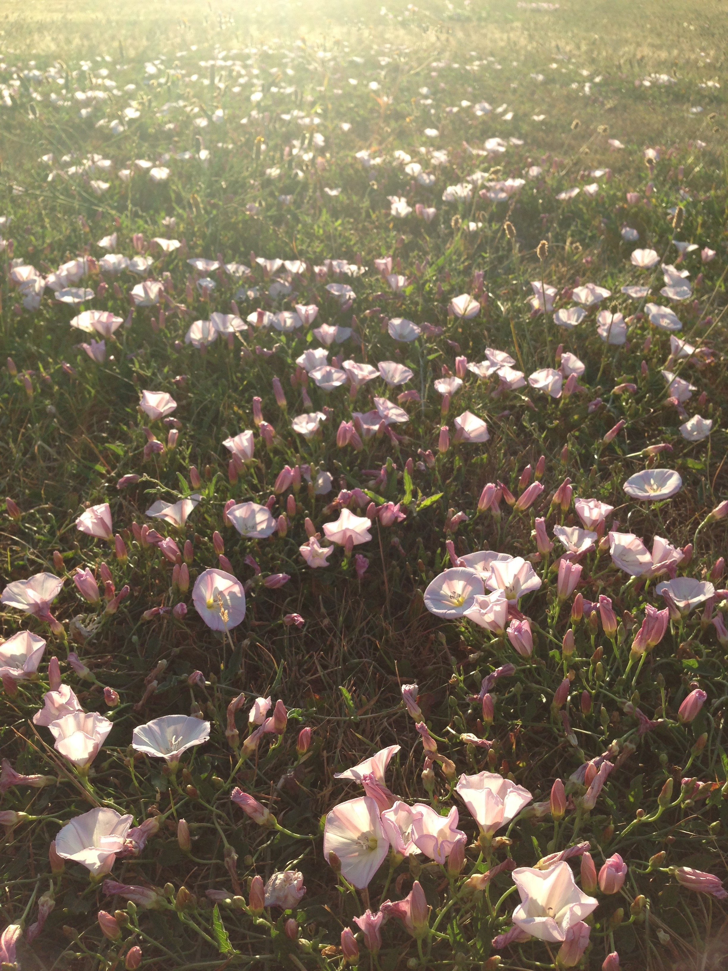
Pink field bindweed drifts on Havelock Rec
At the first small bench along the chain-link fence.
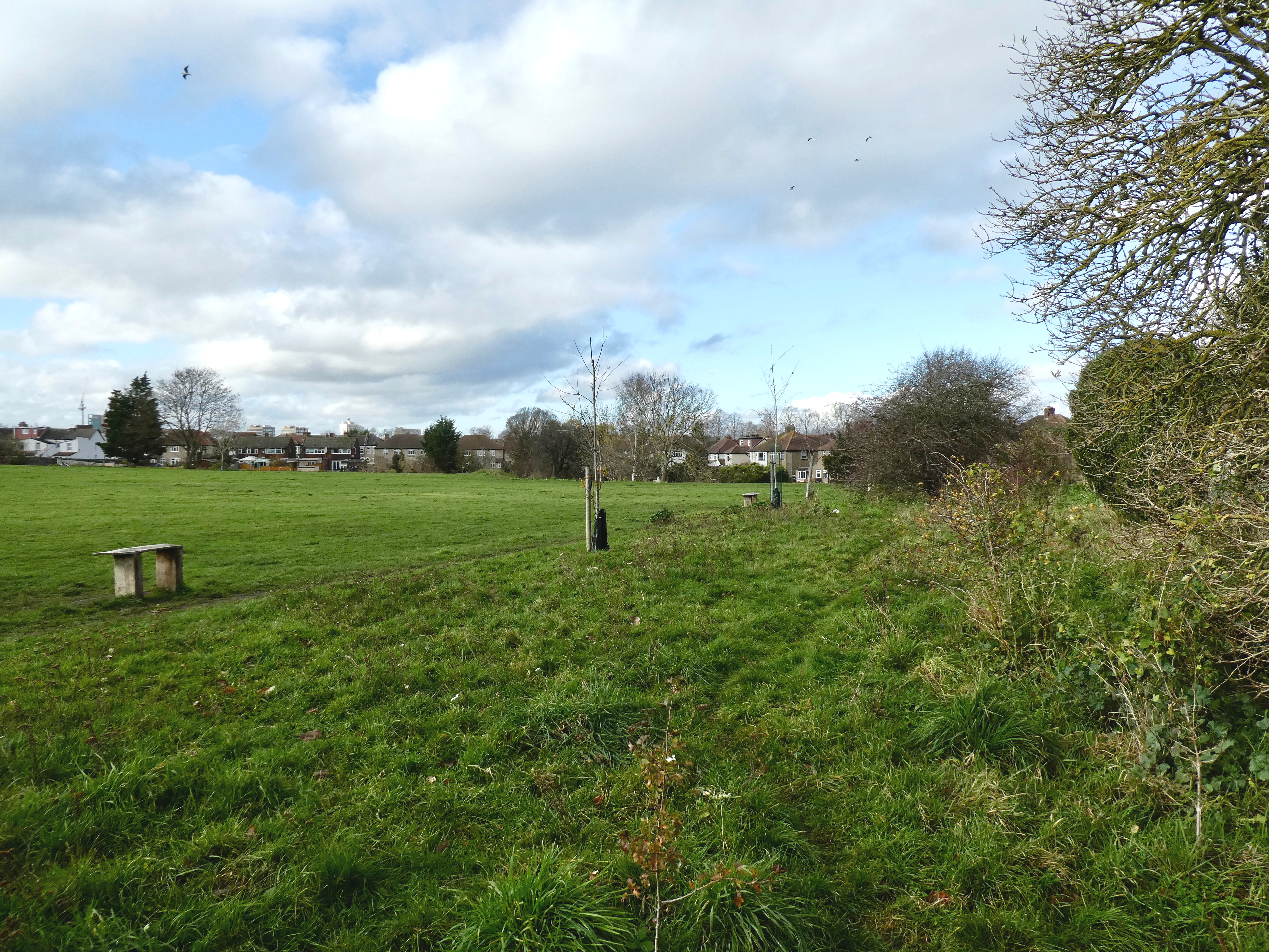
View Havelock Rec from a little bench by the chain linked fence
Narrator: The green lane behind the fence goes through to Waldo Road, and dates from when this was the brickworks.
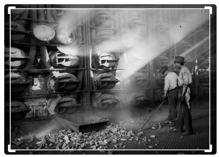
Retort House at the Town Gas works on Old Kent Road. From Getty Images.
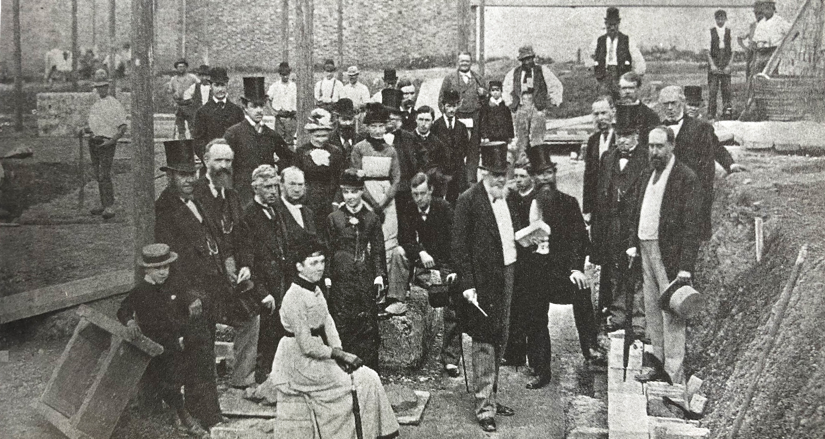
1879 Robinson Latter, clerk to the Local Board, holding brick foundation stone for the new Retort House
Peter’s memory read by Tony: “In one place was a large mound where the lorries from the gasworks sometimes used to come and tip the clinker and by-products from the gas works. Often the local lads used to go and collect bits of coal and coke. It earned quite a few of us a fair bit of pocket money. And then they would tip a tanker of a creosote like product from the local gas works. It lay in the ground like tar. Many a kid had a good hiding after going home with it on your boots, since, after a couple of days the soles of your boots just fell off.”
Jo: The Gas Works were further up Homesdale road and produced Town Gas. This was quite a large site, part of which is now occupied by Tesco, though the site went all the way back to Liddon Road. Until 2018 it contained two huge gas monitors, and when the central European starlings migrate here in the winter to join the local starlings, the monitors provided a huge roost of them.
Peter’s memory read by Tony: “The coke from the gas works? It was regular pocket money for a lot of us. My dad made me a purpose-built barrow that took 28lbs of broken coke (that is what you had to ask for when queuing at the window in the gas works). From memory you could get: a small coke; or a broken coke which was larger lumps; and then boiler nuts (they were a form of compressed coal dust and something else) they were the most expensive and burned very hot.
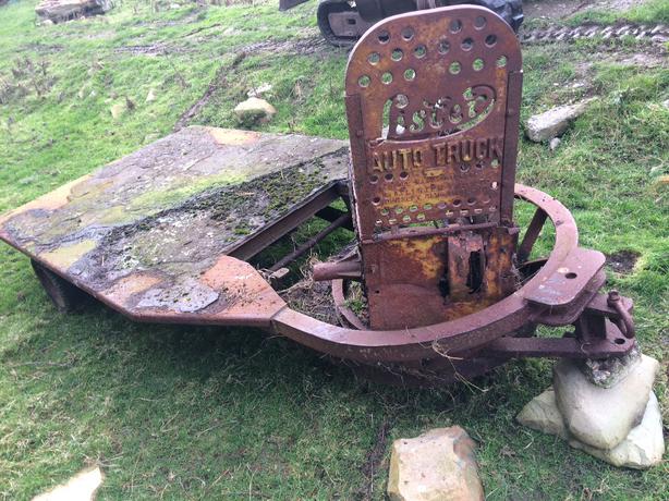
A Lister truck as used at the Gas Works
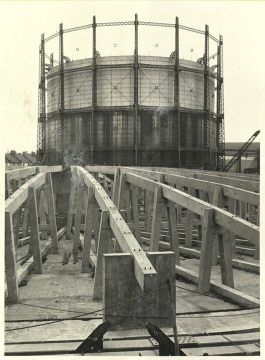
1920s constructing newer gas monitor on Homesdale Road
The Gas Works was I believe run by a Mr Skudder who lived in a house just inside the Main Gate and the ticket windows were further along on the left. You bought your ticket and one of the prisoners of war would take you with your barrow under the hopper and dispensed your measured amount. They, the POWs, would be all over the place driving low trucks called Lister trucks.”
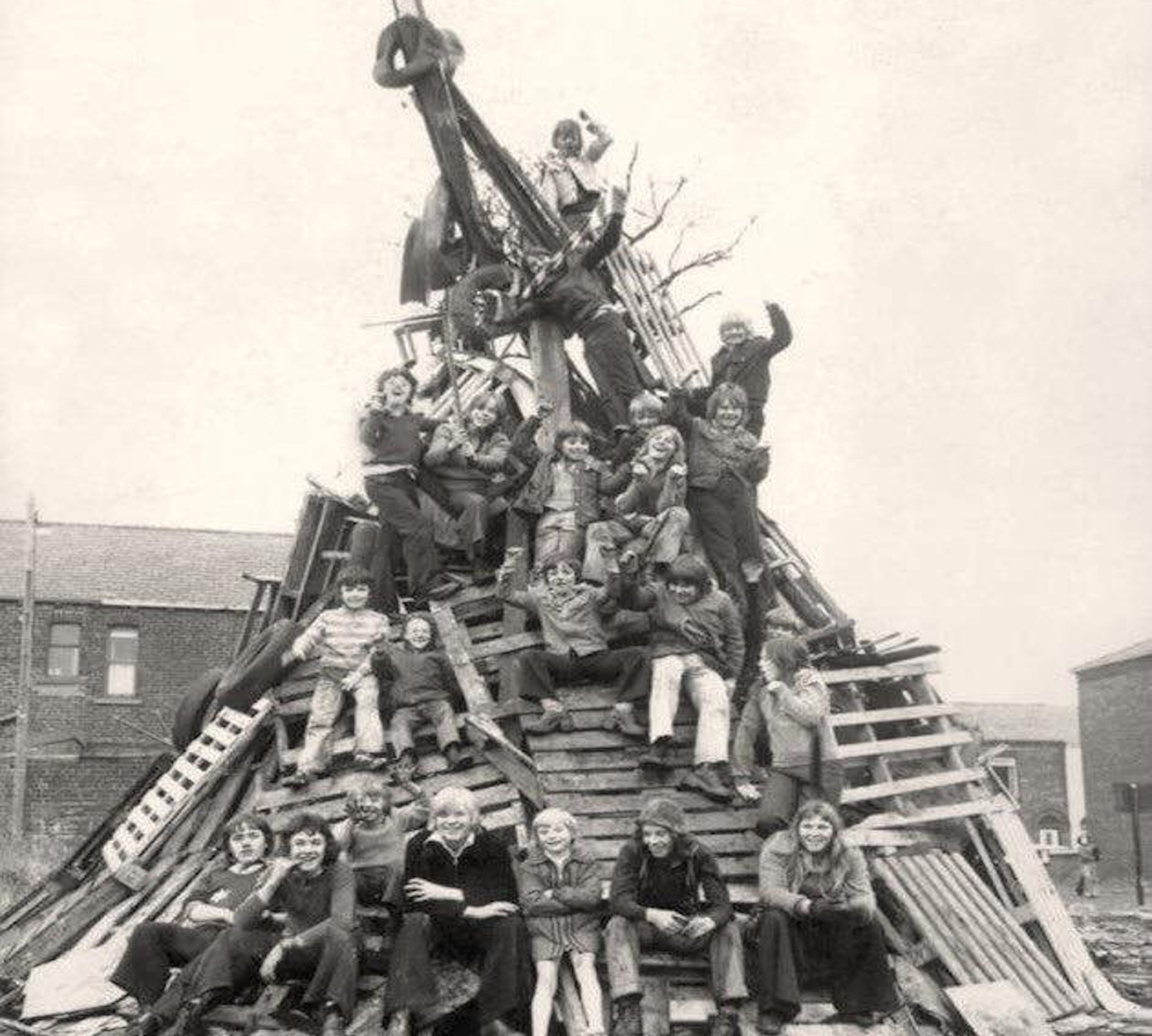
1960s children and bonfire
“Among the rubble there was a constant supply of asbestos sheets that when thrown on any of the numerous bonfires resulted in loud explosions. Be assured I am in no way fantasising or exaggerating.”
Anonymous ladies’ memory, ready by Sandra: We used to have a big bonfire and fireworks on the field for a number of years…
Peter’s memory read by Tony: “Every November the competition to build the largest bonfire caused many a fight as it was almost a nightly job to nick stuff from anywhere you could find. There was always a large one near the Walwyn road entrance.”
Narrator: Continue along the edge of the park to the next entrance to the Green Lane where our neighbours have a large oak tree.
At the Walwyn Road entrance to the Park.
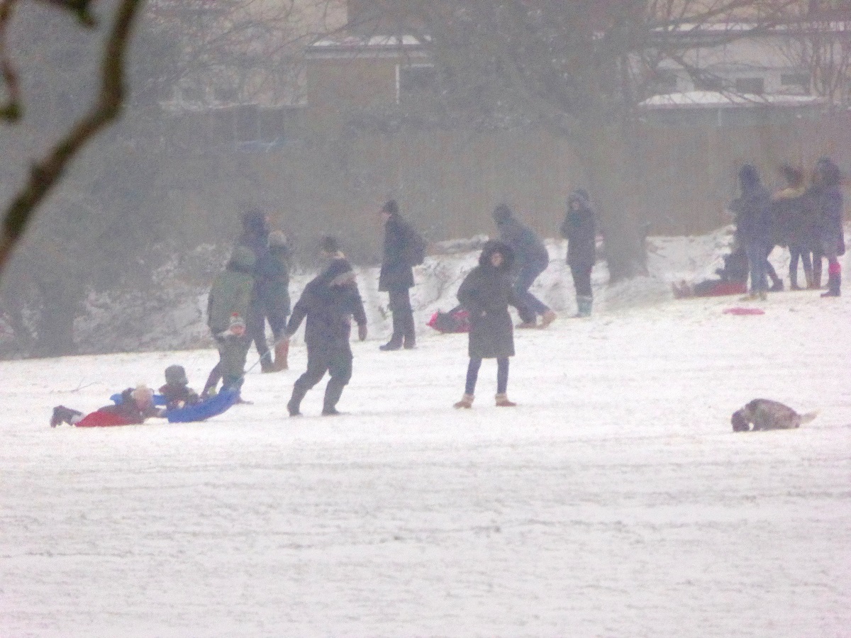
Sledgers on Havelock Rec, thanks to Andy
Narrator: The slope at this end of the dip is the best sledging slope for a long way, and safe enough for small children to enjoy. On snow days, the park is busy, with long queues to take a turn on sledging down!
Narrator: Here are some more recollections about the rubbish being dumped in the pit here. Locals say it was 60 feet deep (that’s about twice the height of house) so it took a few years to fill up:
Peter’s memories: “There were large Horses and their tip Up two wheeled carts that used to tip in to the brickfield. They were stabled in Old Homesdale Road at Mackintosh’s Yard, where there was a Night Watchman during the war, he was Mr Jerry Hodder from Waldo Road. He would sometimes roast a potato for us in his fire.”

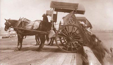
Horse drawn two wheeled dustcart.
Narrated by Phil: At that time, most pupils attended Raglan Road until they were 14, and some of their lessons, were in one of the school extensions, down a track behind the Hayes Lane Baptist chapel (now a pupil referral centre). Children were not given much time to loiter before having to be back to the main buildings for their next lesson (or registration at 4pm), and one local resident, Reg, told us that if one of the horse-drawn rubbish carts was coming up the hill, he and his friend would run out – without the driver spotting them – and hang on the back of the cart. Reg continued:
Reg’s memory read by David: “Sometimes, when they got to the main road, a public-spirited soul would tell the driver that the poor horse had two hangers-on at the back and they would have to jump off. Other times they would get a lift all the way to the Havelock Road entrance to the dump and then they only had one road to walk back down.” Reg in 2018.
Narrator: Continue round the park perimeter, parallel along the line of the chain link fence to the green lane.
At the south end of the Dip.
The dip in Havelock Rec in sunset light
Narrator: Our older residents remember that there was a model railway manufacturer on Homesdale Road:
Reg’s memory read by David: “I would look through the rubbish, with the other lads, that was discarded from the little model railway factory – it was where Excel house now stands by the railway, on the corner between Homesdale and Godwin Roads – in the hopes of adding to their own railway sets (or selling re-usable parts).”
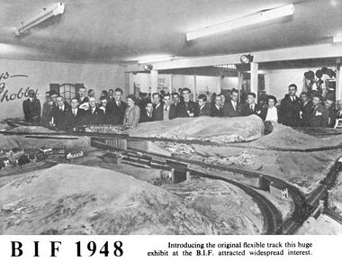
1948 Graham Farish stand at exhibition
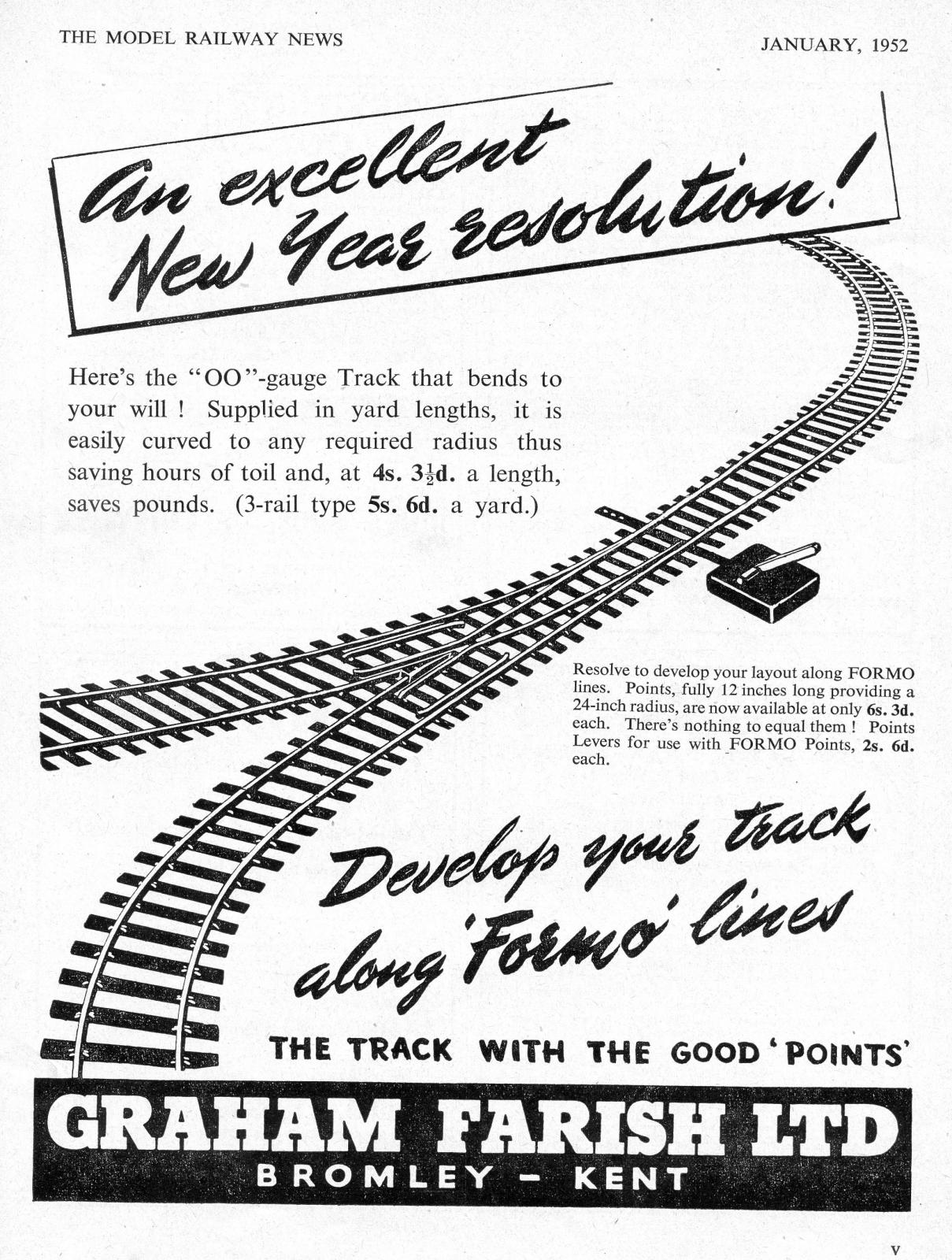
1952 Graham Farish model railway advert
Peter’s memory read by Tony: “The Model Railway Factory was located at the top of Homesdale but on the Main Road and was called Graham Farish. They are still in production and are at the top end both in quality and price. There is a stockist near me in East Grinstead called Martells.”
.Jane’s memory read by Jo: “My husband’s family sold the brickfield – we think late 1920s – have papers from buying not selling. Have some anecdotal stuff – not least mires with cart horses dead in them…” Jane in 2015.
Narrator: Continue along the edge of the vegetation and you will reach another entrance to the park at the end of a wire fence and green lane.

Cow Parsley flowers in the Dip Havelock Rec
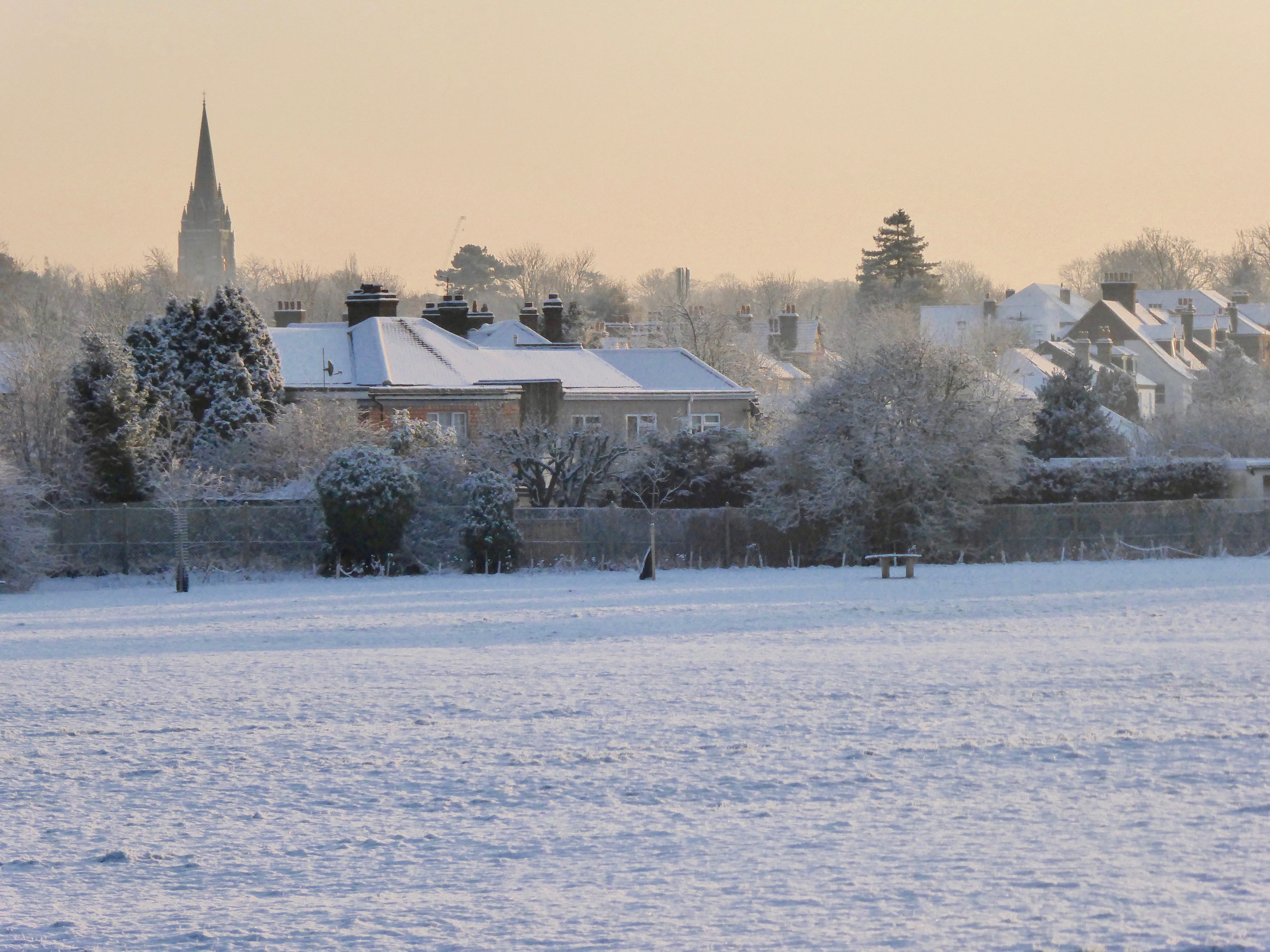
At the north end of the Dip.
Frosty Havelock Rec at Walwyn Road entrance
Narrator: The lower ground to our north is what we call ‘The Dip’. This part of the park was, in the pre-1860s, a smaller brick pit. In those days, clay for brick making was dug from the nearest suitable field, dotting the landscape around here with little pits.
Jo: Although war time was a traumatic experience for the grown-ups, children have better memories of the playtime opportunities of a rubbish dump in the pre-health and safety era…
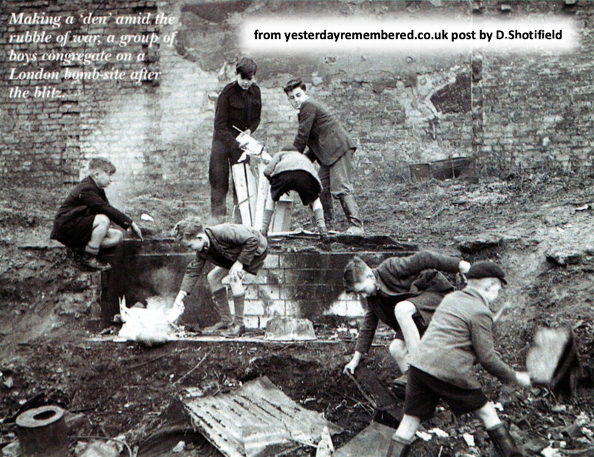
Boys Making a ‘den’ amid the rubble of war, London, from YesterdayRemembered post by D.Shotifield
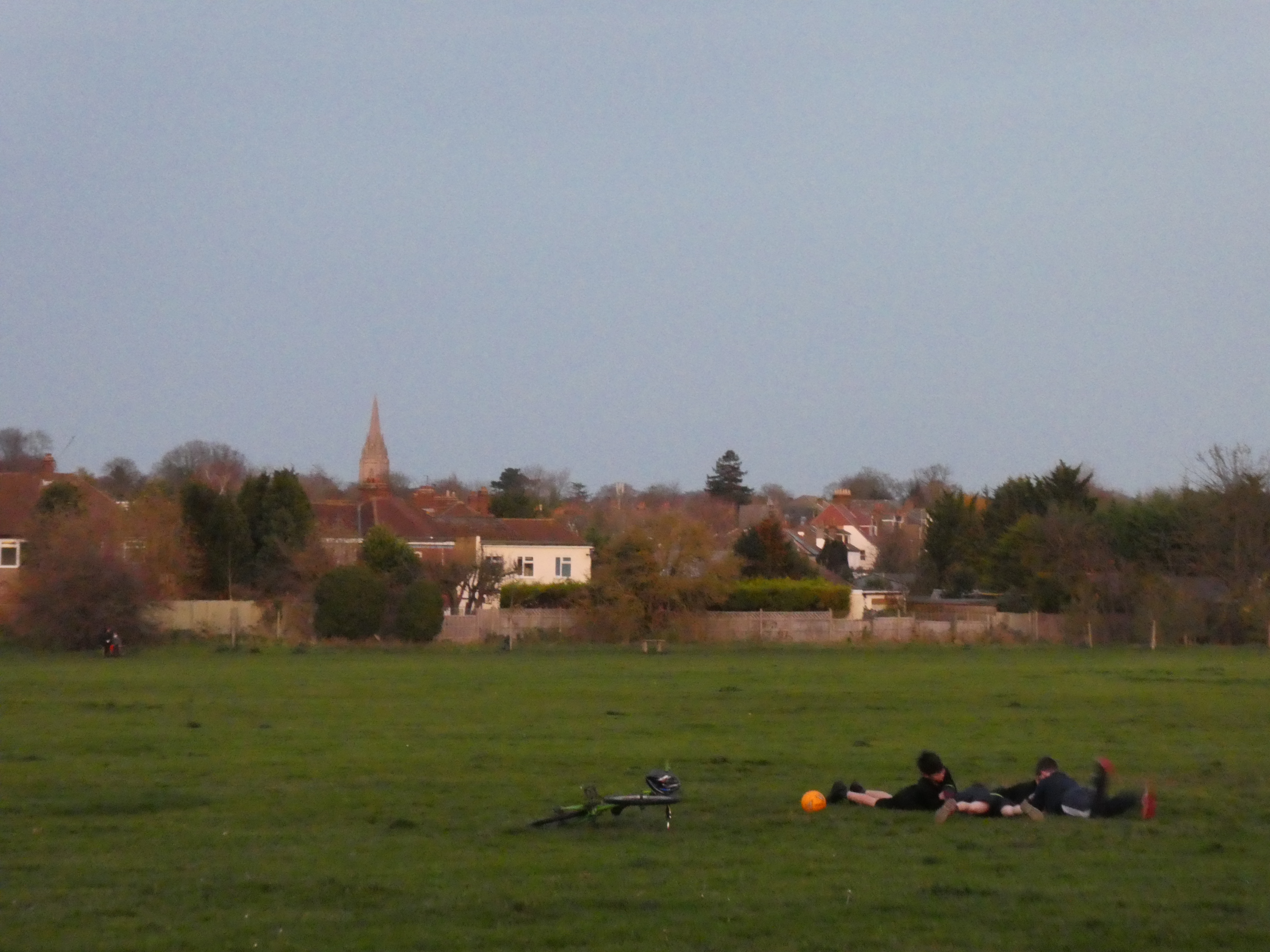
Boys playing on Havelock Rec in the evening light (2020-11-24)
Reg’s memory read by David: “When I was a boy, I used to cut across the brickfield and through all the piles of dumped rubbish, as my family lived in Cannon Road, and I attended Raglan Road school.”
Peter’s memory read by Tony: “To younger kids it was the most fantastic playground you could ever imagine, with new material being tipped there on a daily basis! Many of the kids camps were either in the huge patches of Burdock, that used to grow there, or the older ones made quite large more permanent structures out of the abundance of water tanks. And, “God Help You” if you ever went near or touched a camp belonging to another street.”
Phil narrates: The “Last Input” from the Gas Board was in 1950, and their licence was to use the Brick-pit as a landfill site for “Inert, Industrial and Household waste”.
Narrator: Now follow the edge of the vegetation, around the park to the next stop (about half way along).
Cow Parsley flowers in the Dip Havelock Rec
At the large Sycamore Tree
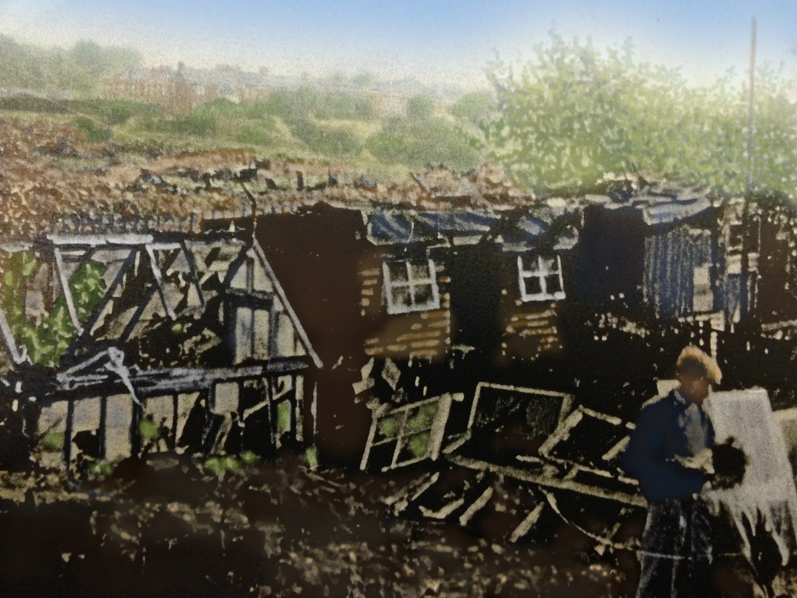
1940 tinted photo of bomb damage in Havelock Road
Narrator: If you look to your left, between the houses, you can see the spire of St George’s church; the 1865 extravagant and classy centrepiece of the villa park, created in Bickley, by a George Wythes Esq. He was an eminent railway constructor who had made a fortune, in Essex and India, and then bought part of the manor of Bromley. He laid out an estate of high-quality suburban villas for the well-to-do city workers. Another mile beyond that is a pub called the Crooked Billet.

St Georges church, Bickley, built for George Wythes.
View in the evening light, of St Georges Bickley, across frosty Havelock Rec
Narrator: The smaller of these two trees is an Aspen, often called quaking Aspen because their leaves tremble in the slightest breeze. This is because the stalks are long and flattened.
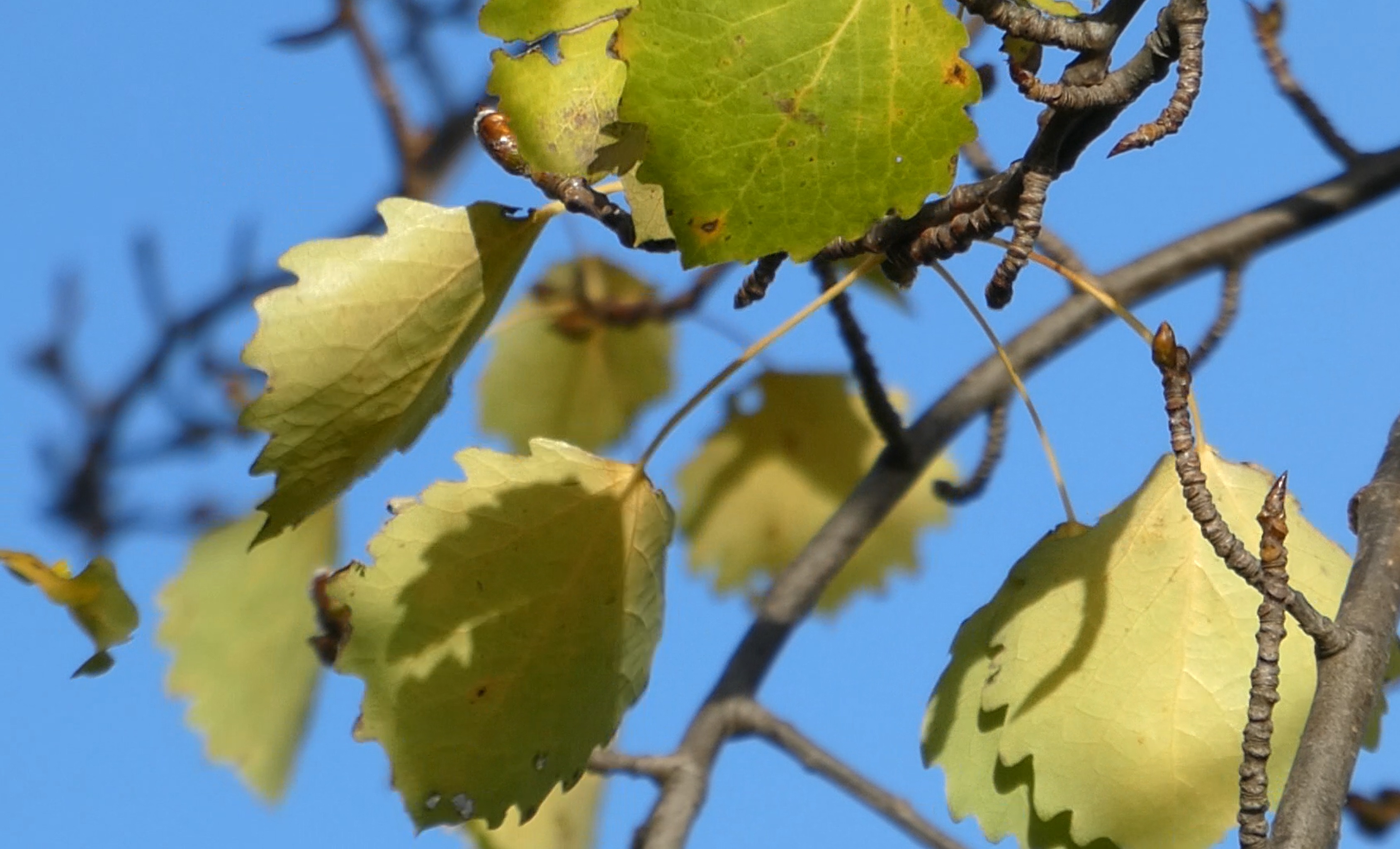
Trembling leaves on the Aspen Tree in Havelock Rec

A pile of rafter and debris is all that remained of the Crooked Billet public house
Rebecca: Bromley (and surrounding areas), were in the direct line to London for V1 and V2 rockets. The Crooked Billet was rebuilt on the site of one of the earliest V2 rocket explosions, on the 19th November, 1944. V2 rockets were launched into space and fell silently and vertically on their targets, so the pub and it’s customers – the pub was full at the time – had no warning. There was only wreckage left of the pub, and neighbouring houses were left gutted. 27 people were killed outright, and many others injured.
Jo, reading the memories of Mrs T Coombes, daughter of J. Pepper (Headmaster of Raglan Road Junior School 1941-59 and previously master in Senior Boys) in Raglan School’s Centenary 1889-1989. Something I shall always associate with wartime is seeding grass – it grew along every pavement and at the bottom of every fence. This contributed to the general air of shabbiness in the streets. The houses mostly had peeling paint, gates leaned on their hinges or were propped open, and windows were obscured by sticky netting or replacement parchment, or were blacked out with old lino or impenetrable dark air raid curtains.
Jo, continuing: . The disused brickfield behind Havelock Road, which was used as a tip for industrial and household rubbish, was an irresistible adventure playground. We called it the Brickie and would sometimes wander there at lunch break and scramble about through the rubbish via little pathways, having to take care to avoid the more unpleasant patches.
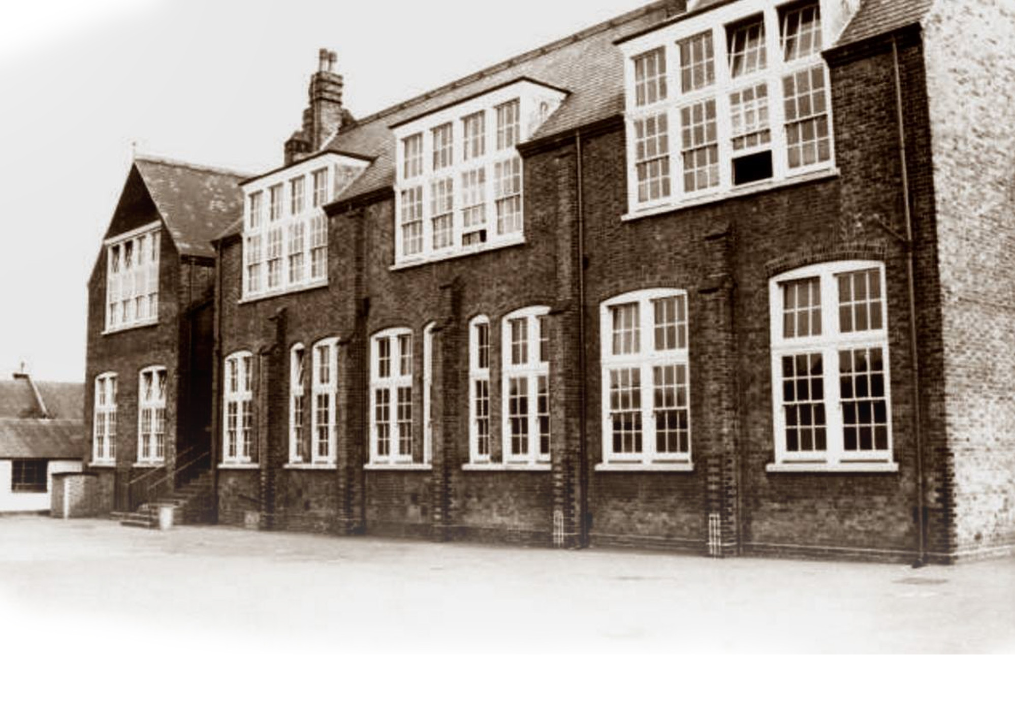
Raglan Road Senior Boys school in 1902
Andrew, reading a memory from an Anonymous gentleman: Beneath the park is rubbish from derelict bomb sites during the war. It was always steaming hot. Some parts of the Rec sink (because of this) so it was deemed unfit to build on – I don’t know if the powers that be still know about this – heaven help us if they built on this ground and it started to sink! I thought I should tell you the history of this land as there are not many of us left in the road to tell this story
Narrator: Continue clock-wise along the perimeter of the park, but stay on the level without going down the slope.
At the Homesdale Road entrance to the park.
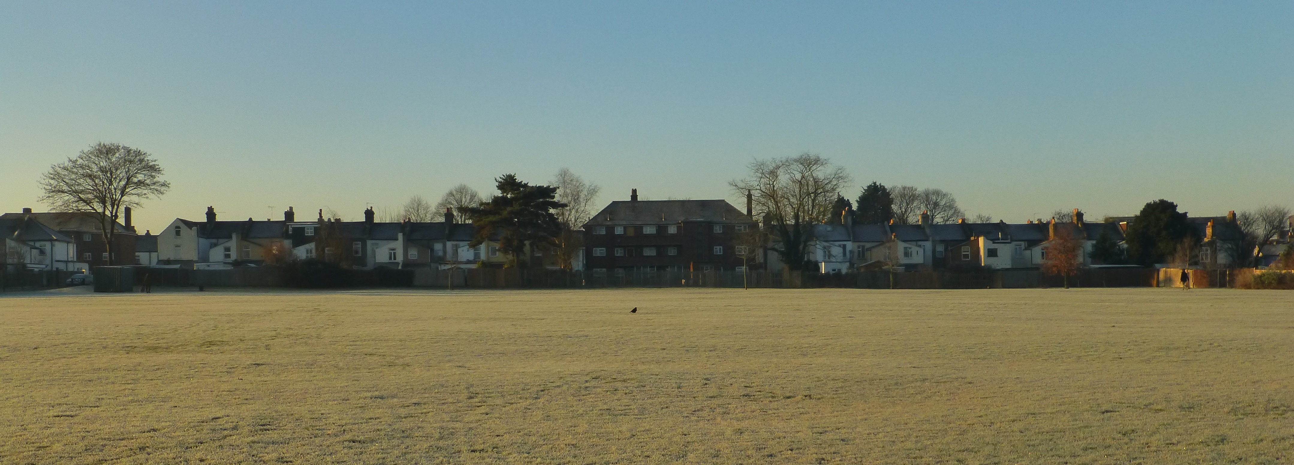
View of the rear of Havelock Road from the park (2020-01-20)
Narrator: If you turn and look back at the rear of the houses along Havelock road, you can see the terrace is interrupted by a block of flats.
Rebecca: In WW2 this area suffered badly from the bombing. Each of the two blocks of flats in Havelock Road mark the sites of houses destroyed by German bombs. The houses from 25 to 41 Havelock Road was demolished by an Aerial Mine, which was more destructive as it detonated above the ground.
Jo: In Jubilee Country Park, you can see the concrete circles marking the site of the Thornet Wood Heavy Anti-Aircraft Battery. It was one of a defensive ring of gun sites encircling London during the War. There were 8 big guns and rows of huts for the reserve unit 71st London Regiment that manned the battery.
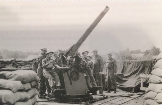
Thornet Wood Heavy Battery gun emplacements in 1941, thanks to Friends of Jubilee Country Park.
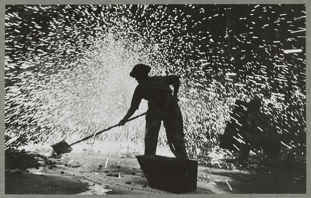
ARP warden with Incendiary Bomb in WW2
Narrator: ‘One day, when we were playing in the Brickie, one of the ARP wardens approached us boys. He told us “For God’s sake don’t do what I’m going to do” and he took an incendiary bomb he was carrying and lobbed it into the pit. It exploded with a blinding flash of white light, and the warden told us “that could have been you”. I can tell you, it fair put the wind up us…!’ Arthur Sheppeck in 2015.
Narrator: Bromley is not far, as the crow flies, from the ww2 fighter station of RAF Biggin Hill, and with the anti-aircraft stationed locally as well, so it didn’t just suffer from not the bombs…
Sandra: On November 9th, 1940, a German Heinkel bomber was shot down by anti-aircraft fire, and it crashed on Johnson Road (half a mile to the south of here), demolishing 2 houses and killing one of the residents.
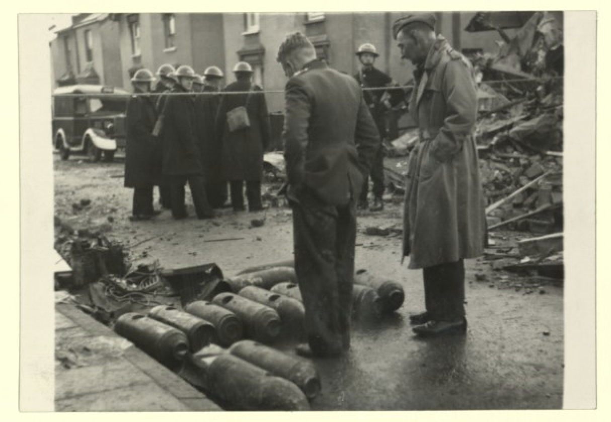
Removing unexploded bombs, Johnson Road. Thanks to Brinley Hawkins.
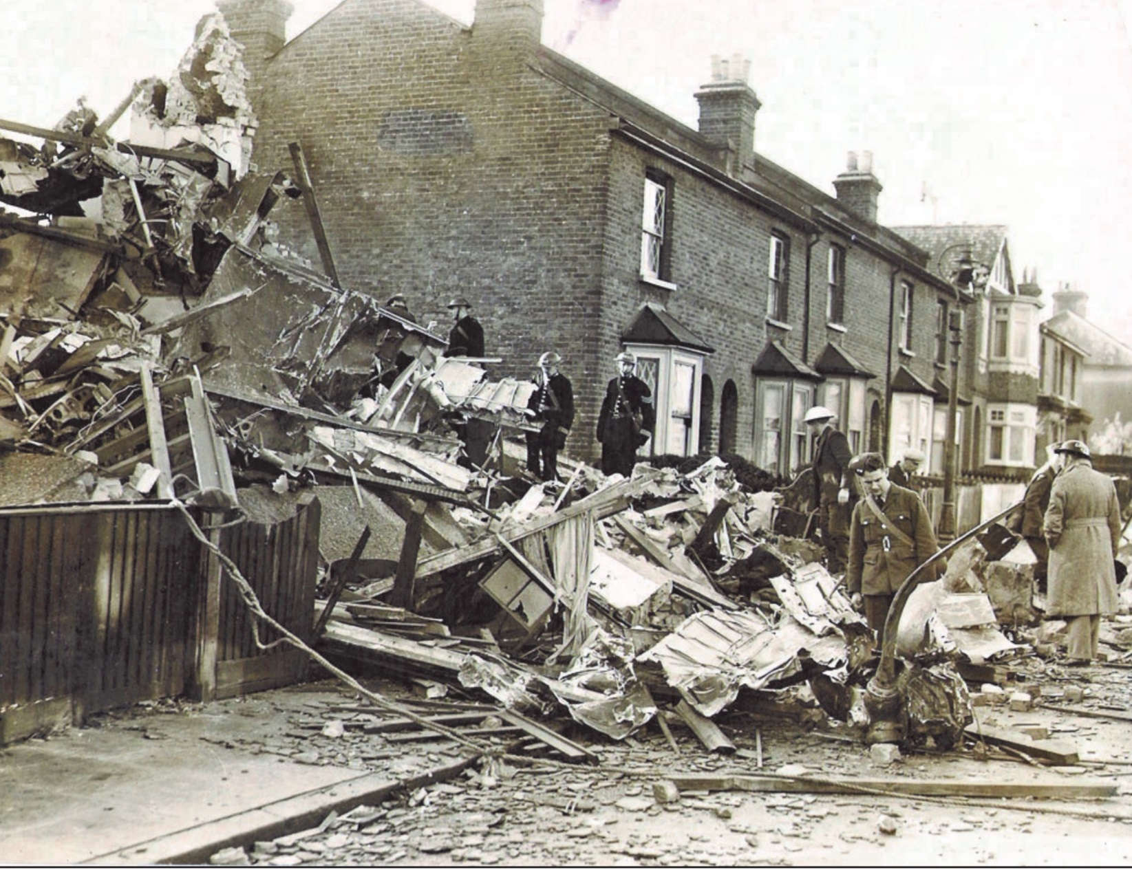
November 10th 1940 Heinkel bomber shot down on Johnson Rd
The bomber still had 30 live bombs on board, which had to be removed carefully by hand to the open space of Bromley Common and defused, by three service men who were awarded George Medals for their bravery.
Jo: From the bombers crew, only the navigator survived; he was arrested when his parachuted into a field near Sundridge Park. If you’re interested, there’s lots more detail on the Chatterton History Society website.
Tony reads Peter’s memory: “One particular occasion was when a large general store in the market square was bombed, much of the rubble was also tipped over there (the brick pit). Some of the local Mums soon spent some time over there recovering molten bars of soap and other items.”
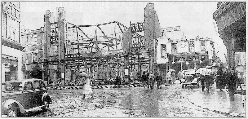
April 16th, 1941. The bombed out Dunns furniture store
Narrator: Continue clockwise around the edge of the park until you reach a large Sycamore tree on your left.

Misty view down Raglan Avenue from the Homesdale Road entrance to the Park.